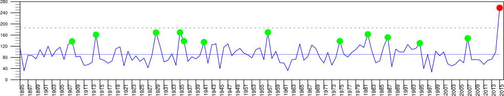
– El Nino and Texas Precipitation
All plots preliminary.
Right click to see bigger versions.
New Most recent plots first.
How do El Ninos and/or Climate Change affect TX OK May precip?
Old Figures for Cheng et al 2016 paper here
Older versions at bottom.
All 'El Ninos' refer to May El Ninos unless stated otherwise
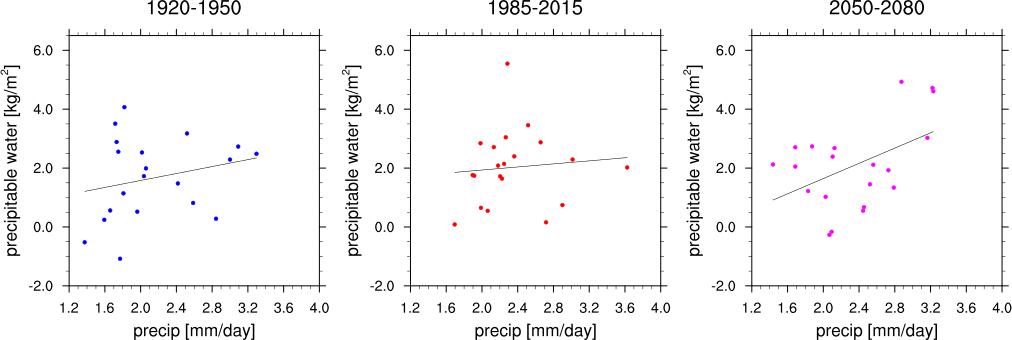
New scatter plot figure
sample linear Pearson lag 0 cross-correlations between precip and precipitable water
are 0.2376223, 0.0928401,0.4706743, respectively, for 3 periods.
--------------------------------------------------------------------------------------------------
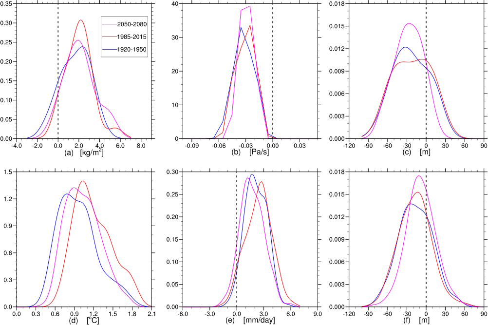
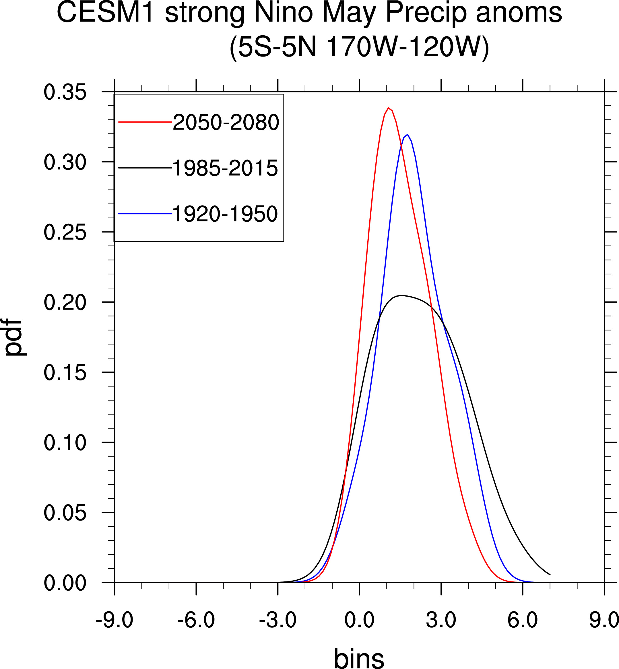
New Figure 12: CESM1 data, May El Ninos
Note: For Figure 12 area averages computed using cos(lat) weights
---------------------------------------------------------------------------------------------------------- -------
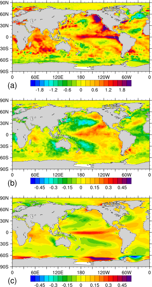
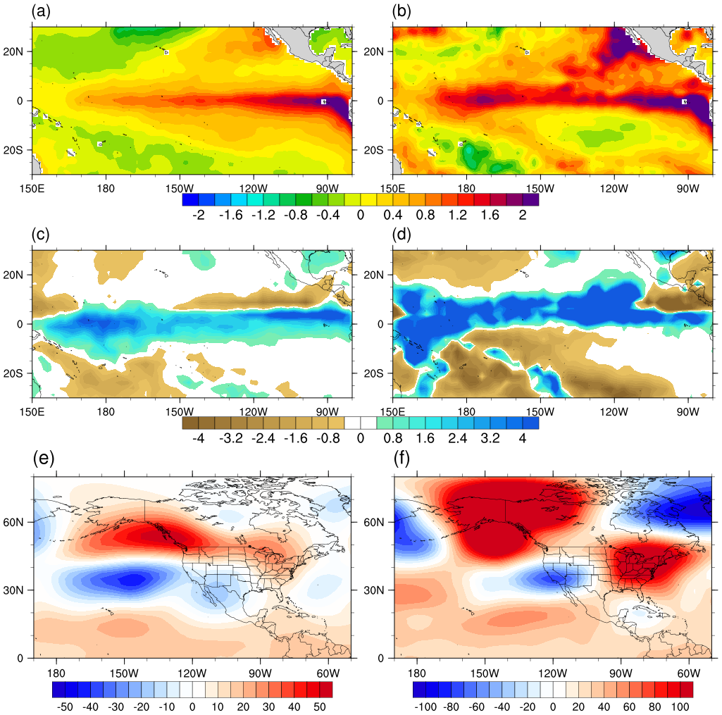
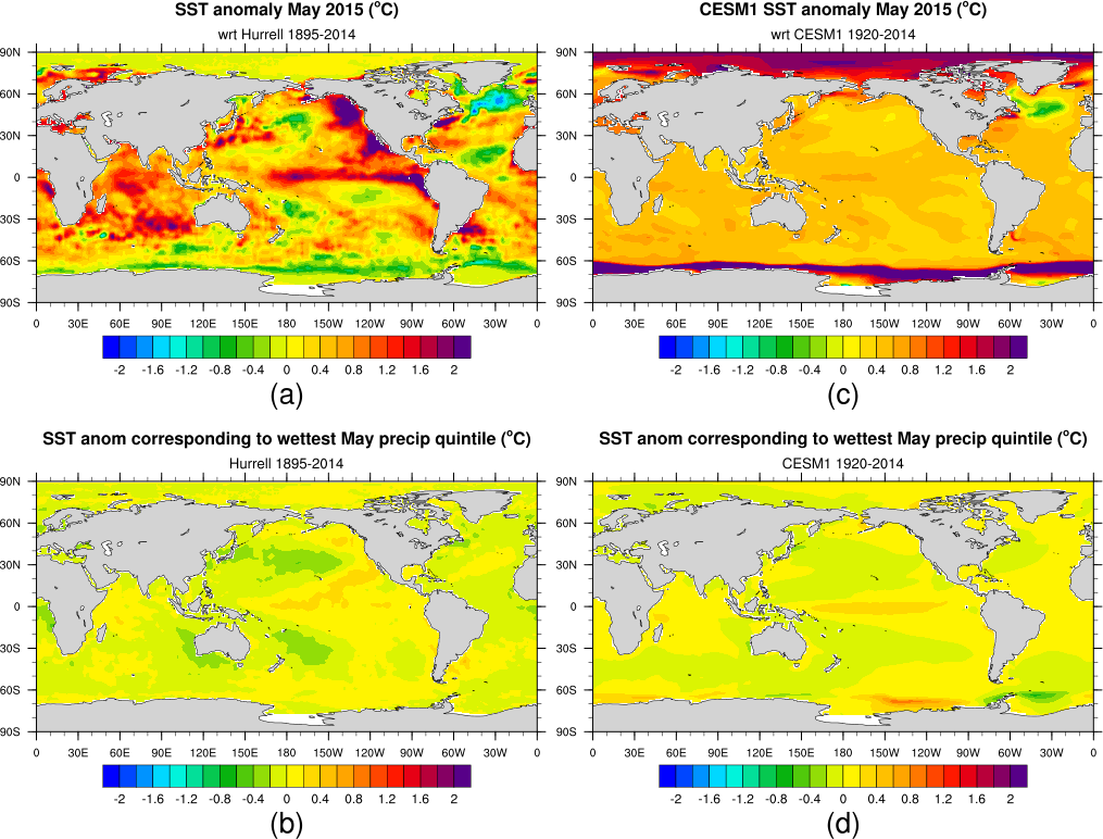
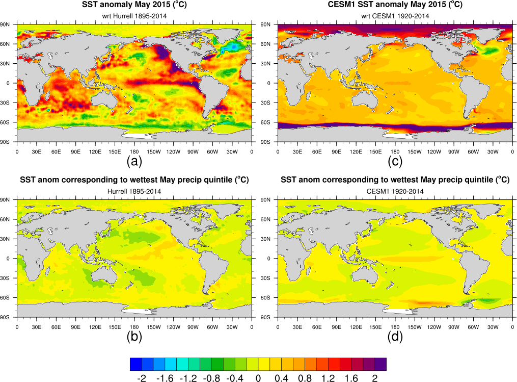
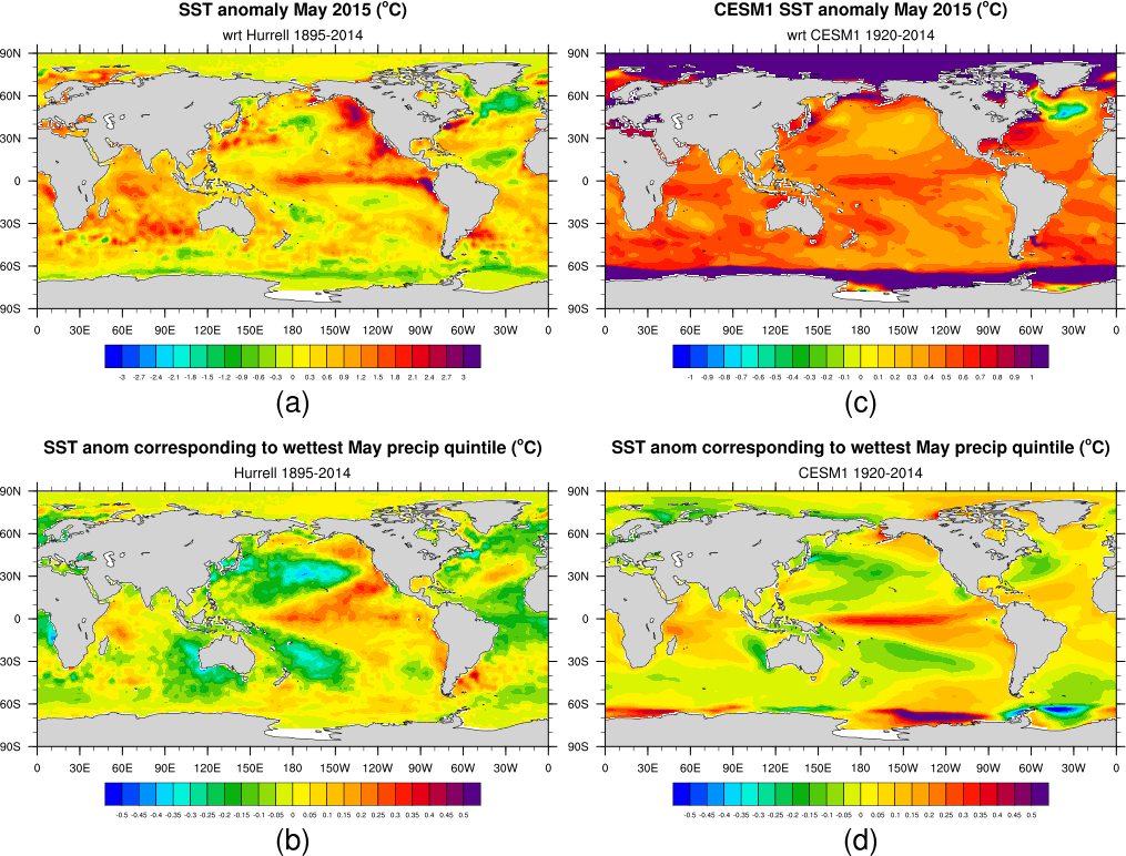
Figure 5: top plot is May 2015 Hurrell SST anomaly wrt Hurrell 1948-2014
middle is Hurrell SST anom (wrt 1895-2014) corresponding to wettest May precip quintile
bottom is CESM1 SST anom (wrt 1920-2014) corresponding to wettest May precip quintile
---------------------------------------------------------------------------------------------------------- -------
Figure 13: 2050-2080 minus 1920-1950 Mays
TX/OK Trefht diff=3.612579 oC
TX/OK precip diff=6.018614 %
TX/OK tot precip water diff=22.68843 %
top is CESM1 Trefht [oC], middle is CESM1 Precip [%], bottom is CESM1 total precipitable water [%]

---------------------------------------------------------------------------------------------------------- -------
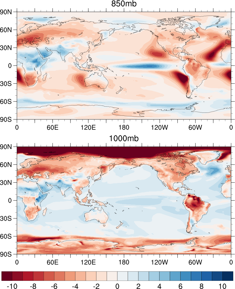
Figure 14: CESM1 relative humidity [%], 2050-2080 minus 1920-1950
850mb TX/OK rel hum diff=-2.350683 %
1000mb TX/OK rel hum diff=-2.537276 %
-----------------------------------------------------------------------------------------------------------------
Appendix Figure 3 (former Figure 11): CESM1 Z250 [m]
left column is CESM1 El Ninos, right column is CESM1 top El Ninos (based on TX/OK precip)
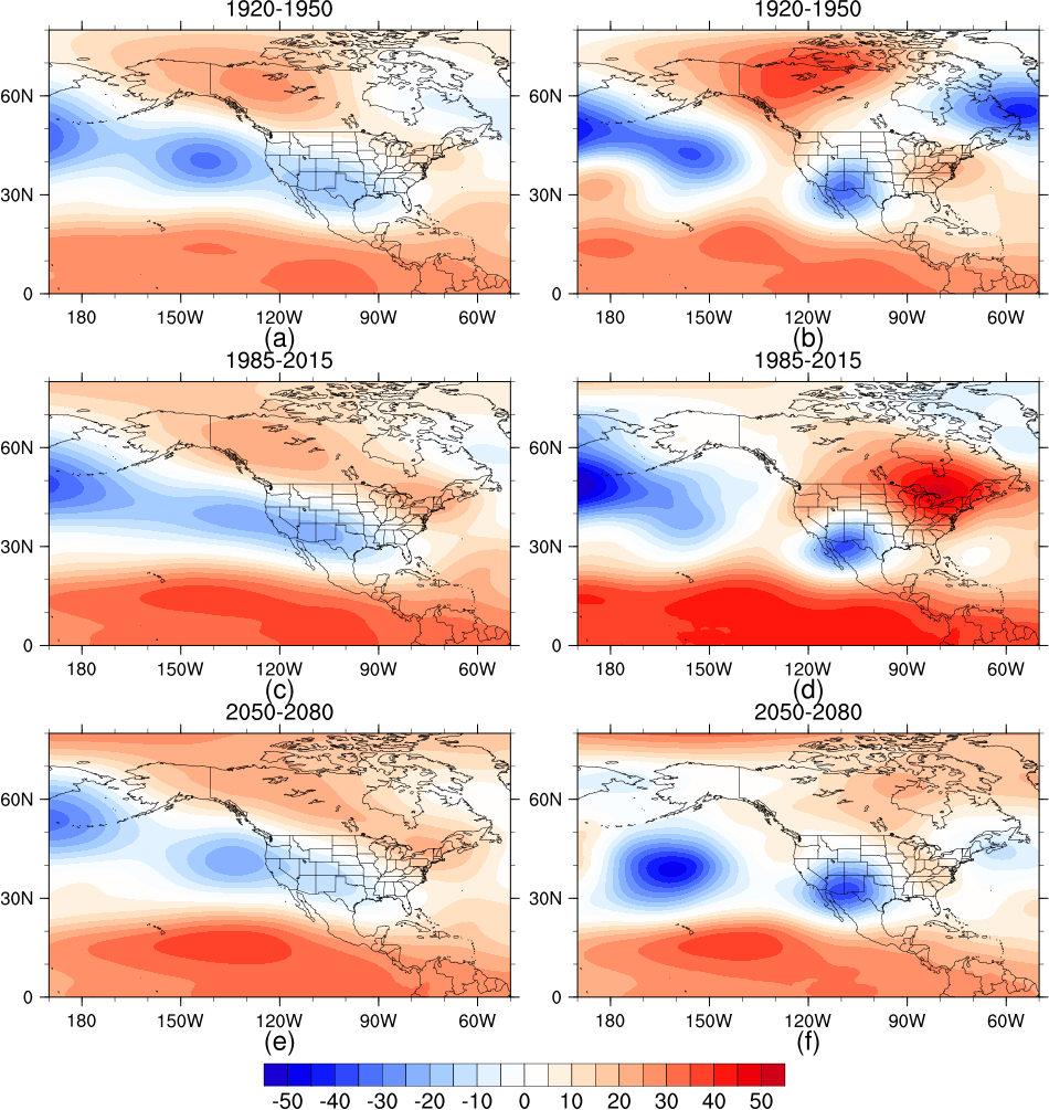
Appendix Figure 2 (former Figure 10): CESM1 precip [mm/day]
left column is CESM1 El Ninos, right column is CESM1 top El Ninos (based on TX/OK precip)
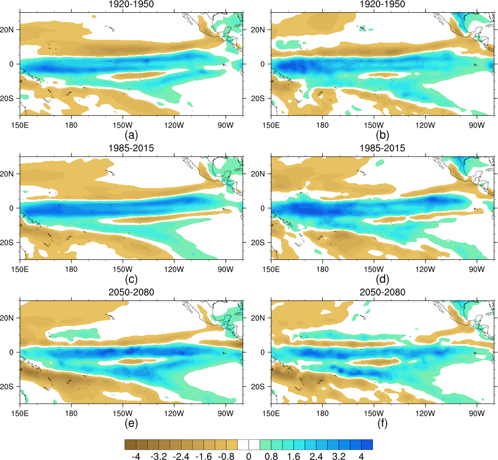
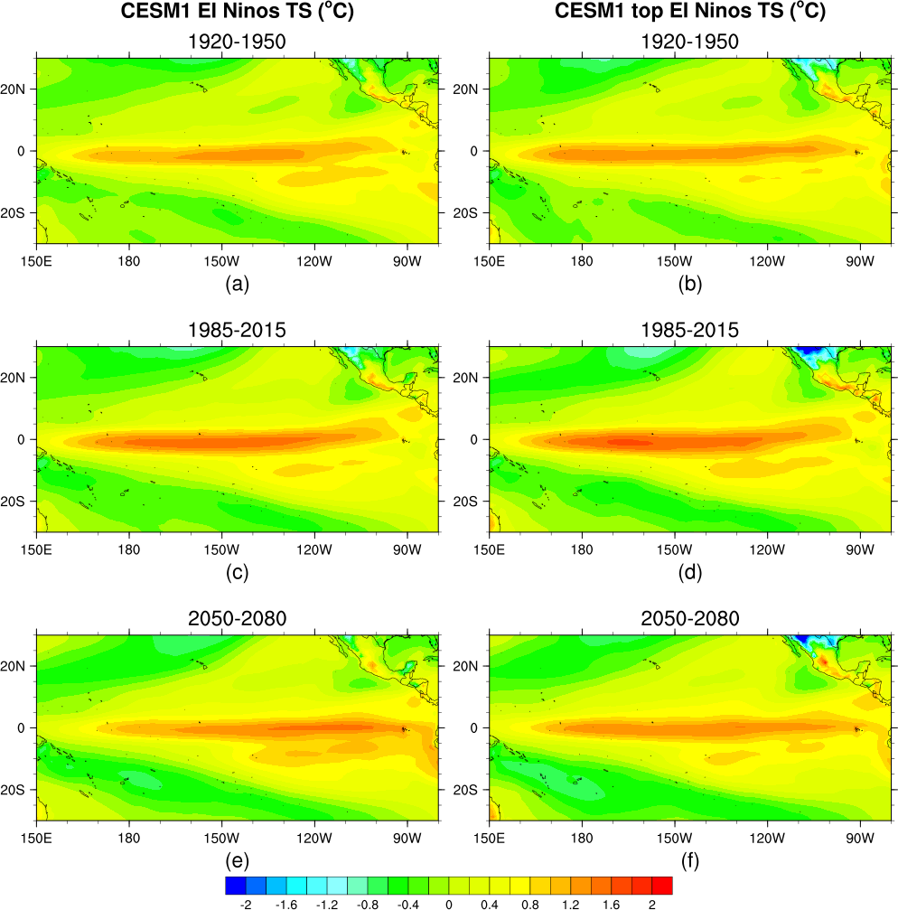
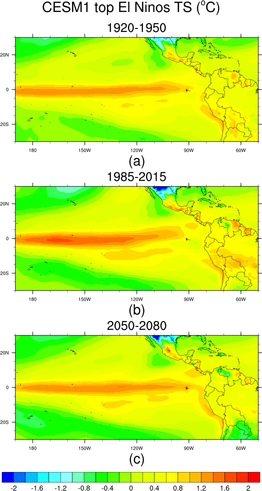
Appendix Figure 1 (former Figure 9): CESM1 TS [oC]
left column is CESM1 El Ninos, right column is CESM1 top El Ninos (based on TX/OK precip)

------------------------------------------------------------------------------------------------------------------
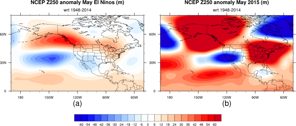
Figure 8: left column is Hurrell SST [oC], CMAP Precip [mm/day], NCEP Z250 [m] El Nino anomalies,
right column is Hurrell SST, CMAP Precip, NCEP Z250 May 2015 anomalies
--------------------------------------------------------------------------------
Figure 1:
--------------------------------------------------------------------------------
Figure 2:

--------------------------------------------------------------------------------
Figure 12: CESM1 data, strong May El Ninos ("strong" based on TX/OK precip)
top row for TX/OK region (28N-37N, 104W-94W)
bottom row for 5S-5N, 170W-120W, or 25N-40N 115W-100W for Z250.
Note: For Figure 12 area averages computed using cos(lat) weights

Preliminary figures for Figure 12:


--------------------------------------------------------------------------------
Figure 8:

--------------------------------------------------------------------------------
Figure 10:

--------------------------------------------------------------------------------
Figure 9:
--------------------------------------------------------------------------------

--------------------------------------------------------------------------------

--------------------------------------------------------------------------------

--------------------------------------------------------------------------------
--------------------------------------------------------------------------------
--------------------------------------------------------------------------------
--------------------------------------------------------------------------------
--------------------------------------------------------------------------------
--------------------------------------------------------------------------------

--------------------------------------------------------------------------------
--------------------------------------------------------------------------------