TexAQS 2006 TOPAZ Lidar data
Final Data
| August 2006 | ||||||
|---|---|---|---|---|---|---|
| S | M | T | W | R | F | S |
| 1 | 2 | 3 | 4 | 5 | ||
| 6 | 7 | 8 | 9 | 10 | 11 | 12 |
| 13 | 14 | 15 | 16 | 17 | 18 | 19 |
| 20 | 21 | 22 | 23 | 24 | 25 | 26 |
| 27 | 28 | 29 | 30 | 31 | ||
| September 2006 | ||||||
|---|---|---|---|---|---|---|
| S | M | T | W | R | F | S |
| 1 | 2 | |||||
| 3 | 4 | 5 | 6 | 7 | 8 | 9 |
| 10 | 11 | 12 | 13 | 14 | 15 | 16 |
| 17 | 18 | 19 | 20 | 21 | 22 | 23 |
| 24 | 25 | 26 | 27 | 28 | 29 | 30 |
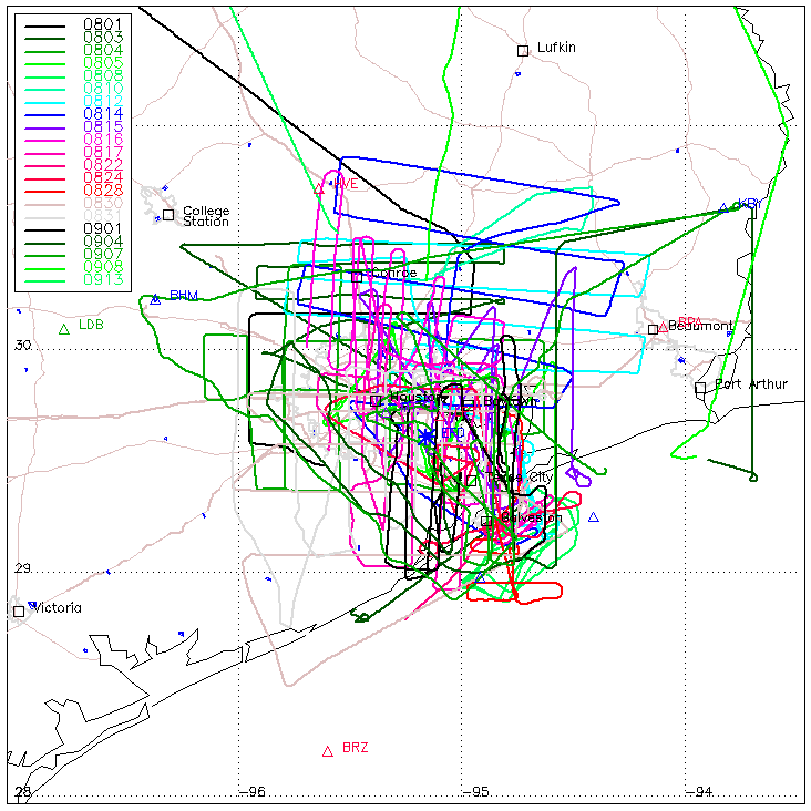
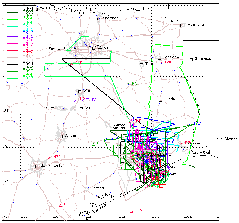
During the TexAQS 2006 study, the NOAA Twin Otter flew 22 missions totaling about 121 hours between 1 August and 13 September 2006, covering the Houston, Dallas/Forth Worth, and eastern Texas areas.
| Twin Otter flight track map for Houston area | Twin Otter flight track map for all of eastern Texas |
 |
 |
Data Status: Data are quality controlled, and listed as final (version 2).
Data Policy: We request that a proper acknowledgment to the "NOAA Earth System Research Laboratory Chemical Sciences Divison" accompany the use of this data in any publications and presentations. If the use of this data in a publication constitutes a major or reasonably significant aspect of an article, co-authorship by an ESRL CSD scientist is appropriate; please discuss any such planned use with the contact scientist. We welcome collaborations and will lend our scientific expertise in interpretation and evaluation of the data.