TexAQS 2006 TOPAZ Lidar data
August 10 - Final Data
| Previous Flight | Archive Calendar | Next Flight |
|---|
Flight #6
Takeoff: 13:51 CDT
Total flight time: 3.2 hours
An ozone plume was forecast to develop over the Ship Channel area around midday and then move north in southerly winds in the afternoon. The Twin Otter flight plan was designed to fly an E-W upwind leg between Galveston and Texas City to characterize background ozone and aerosol levels and then head NE across the Ship Channel area and repeat a box pattern 2 to 3 times north of Houston. This forecast did not materialize. Clouds, thunderstorms, and widespread precipitation developed over the Houston area shortly after takeoff. The Twin Otter spent most of the time evading clouds and precipitation and only collected about 45 minutes worth of data to the northeast of Houston, where ozone concentrations of 50 to 70 ppb were observed.
Select an image to view full resolution
Ozone Cross-section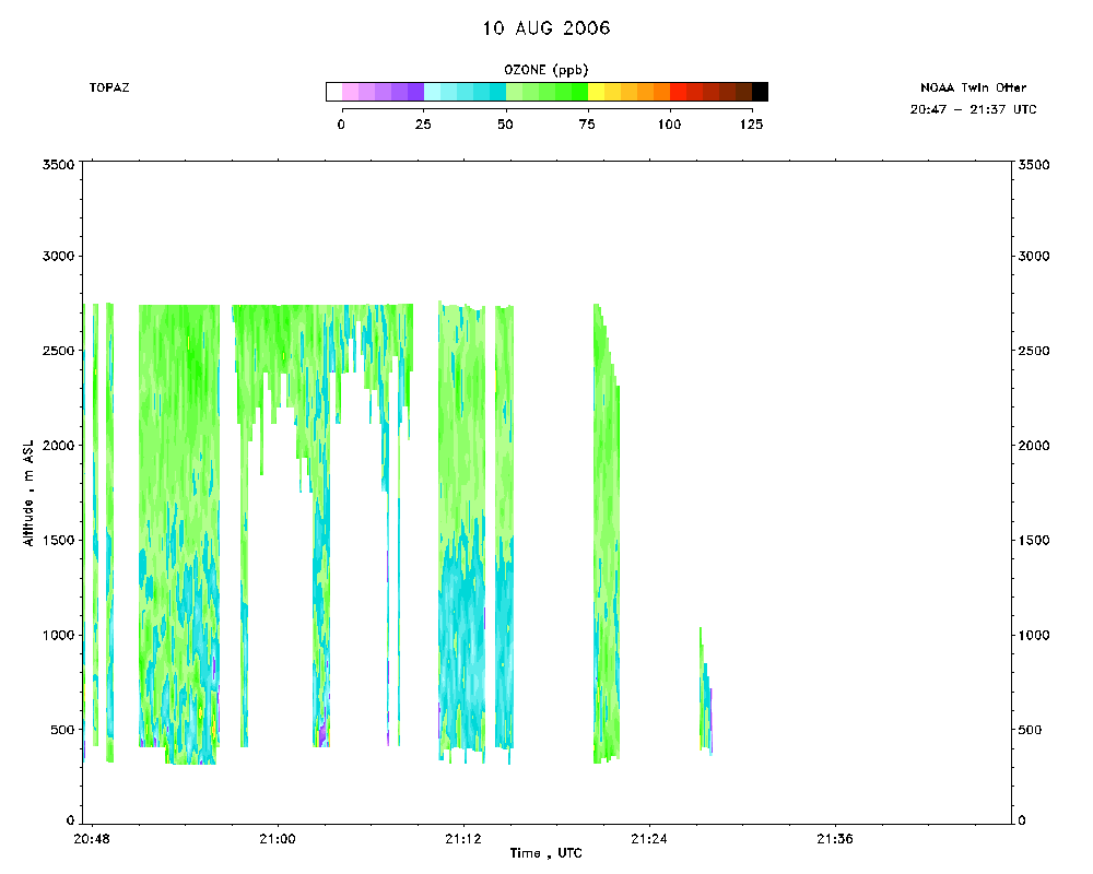 download ICARTT format data (ict file) download simple ASCII data (txt file) |
Aerosol Cross-section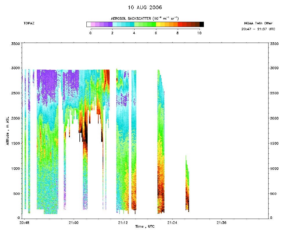 download ICARTT format data (ict file) download simple ASCII data (txt file) |
Ozone Map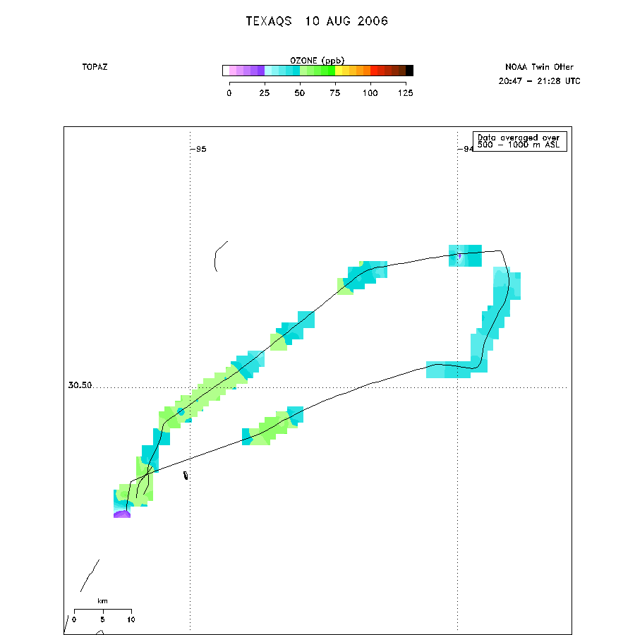 |