Forecast Models
These forecast models are part of the ICARTT 2004 Modeling and Forecasting sites.
 Regional Air Quality Forecast Models
- Real-time comparison phase based on the preliminary field measurements
- Post-field study phase where evaluations are performed for the entire summer based on the preliminary measurements
- Final evaluation phase based on finalized, quality assured data
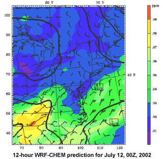
It is anticipated that models will be run during 2004 to evaluate skill at predicting ozone photochemistry and PM10 and PM2.5 aerosol concentration. Forecasts will be available at several model resolutions. Nested domains of 4 and 12 km centered over the northeast U.S. within a 36 km grid covering the entire U.S. for the WRF-CHEM model are currently being considered. The two regional-scale forecast models (CMAQ-ETA and WRF-CHEM) are the top priorities in terms of model evaluation studies due to their spatial detail, the effort and expense put into the basic physics and dynamics, and the importance they serve as operational or community based forecast models.
Additional Air Quality Models
- Harvard University GEOS-CHEM model
- MOZART model from NOAA GFDL
- University of Iowa long-range transport model
- FLEXPART trajectory based model of Andreas Stohl
- Baron Advanced Meteorological Systems MAQSIP-RT model
Model Evaluation
- Real-time comparisons of model forecasts for the ground-based and ship-based observations
- Comparisons of model forecast results with the aircraft platform(s)
- Comparisons of model forecast aerosol fields with the observations

