
Observing System Science Team
The Observing System Science Team (OSST) manages the Water Cycle Branch's world-class observing assets. OSST is responsible for deploying, operating, and maintaining a variety of in situ and ground-based remote sensors for the Branch's diverse field programs. OSST also manages and archives the observational field data that are collected and generates real-time displays of the data for use by operational forecasters; other users of weather information in government, private, and academic institutions; and the general public. In addition to field work, OSST makes improvements to existing instruments to expand their utility to a particular observing application and designs new instruments to make unprecedented measurements of the atmosphere and earth's surface. These activities require engineering talents that focus on adapting equipment for use in often extreme environments and on improving instrument and data communication automation and reliability.
The current observing assets include:
- Deployable networks of 15 radar wind profilers with radio acoustic sounding systems for wind and temperature profiling
- Five vertically pointing precipitation profilers (S-PROFs)
- Doppler scanning radar at X-band with dual polarimetric capabilities (HYDRO-X)
- Doppler scanning radar at C-band (SkyWater)
- GPS radiosonde system
- Approximately two dozen meteorological towers that provide measurements of the average state variables of the lower atmosphere as well as precipitation, integrated water vapor, and soil moisture, and vertically integrated water vapor aloft.
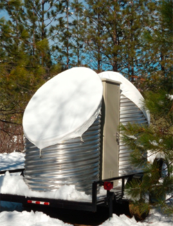
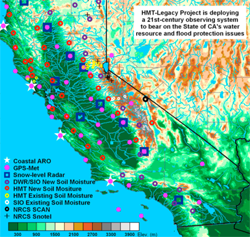
OSST has participated in field research campaigns addressing air quality, air-sea interaction, boundary-layer processes, hydrometeorological processes, polar processes, and renewable energy. Recently, the OSST deployed a first-of-its kind eight-station network of 1/4-scale 449-MHz wind profilers, designed and built by OSST staff specifically to support the U.S. Air Force's Tethered Atmospheric Radar System. More recently, OSST is leading a project with the California Department of Water Resources (CA-DWR) to install a 21st-century observing network to help CA-DWR deal with its water management and flood protection issues. In particular, this network will detect and monitor the forcings of extreme precipitation and flooding, with a special emphasis on atmospheric river conditions. For this project, OSST engineers designed a new frequency-modulated, continuous-wave S-band radar for improving the efficiency and reducing the cost of making atmospheric observations of the snow level. Because variability of the rain-snow line can have a large impact on the hydrologic response of watersheds, especially in steep terrain, snow-level observations are an important tool for operational forecasters. These snow-level radars are being deployed at ten major reservoirs across California. These two projects with external agencies, in addition to the dozens of field research projects supported by OSST within NOAA and elsewhere, are evidence of the team's leadership, innovation, adaptability, and reliability with respect to observing system science.