North Pacific Analyses during ENRR
This page displays analyses of sea-level pressure (pmsl) over the north Pacific (NPac; 0-60°N, 130°E-110°W) during January through April 2016. There are 4 maps per day (at 00, 06, 12, and 18UTC); the 18 UTC maps from 11 Jan and 7 Apr 2016 are missing.
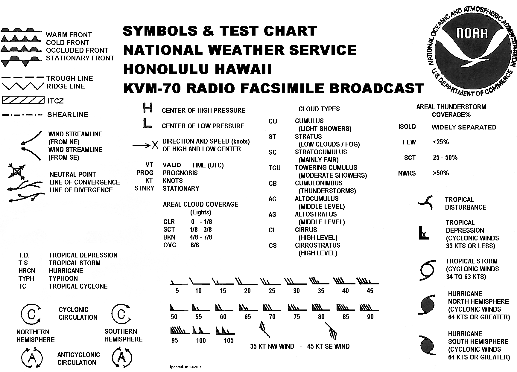
These maps are very similar to those produced by the NOAA/NWS/Pacific Region Headquarters in real time: "North Pacific Surface Analysis (130E-110W,EQ-60N) From the Unified Surface Analysis". The major differences are the lack of station observations and the lack of NOAA/NWS/PRH logo. A black-and-white key containing many of the symbols used in the chart can be found on the above web page ("Symbols & Test Chart"); a copy has been put here. A more detailed color description of the symbols can be found in Chapter 3 of the "Unified Surface Analysis Manual" which was downloaded from the NWS Ocean Prediction Center.
These maps were produced using GEMPAK by W. David Plummer (National Centers AWIPS Team Lead, NCEP Central Operations / Systems Integration Branch) from *.vgf files provided by Raymond Tanabe (Director, NWS Pacific Region). If you use them, we ask that you cite PSL as in "Image provided by the NOAA-ESRL Physical Sciences Laboratory, Boulder Colorado from their Web site at http://psl.noaa.gov/"
Note: The image file naming convention is npac_pmsl.2016mmdd_hh.gif, where
- npac = region covered
- pmsl = variable (sea-level pressure)
- 2016 = UTC year
- mm = UTC month
- dd = UTC day
- hh = UTC hour