Part I. Location and Frequency of Highly Refelctive Clouds:
Means of Monthly Data
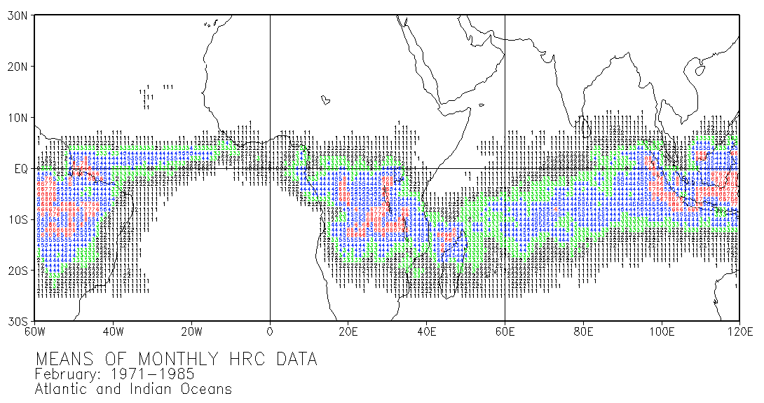
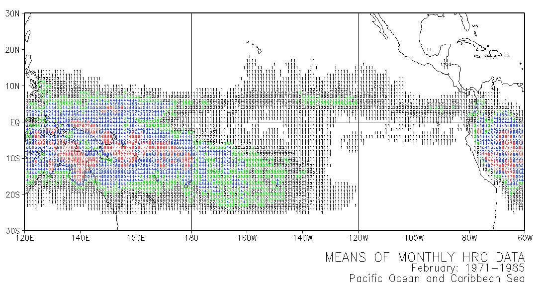
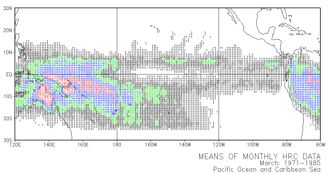
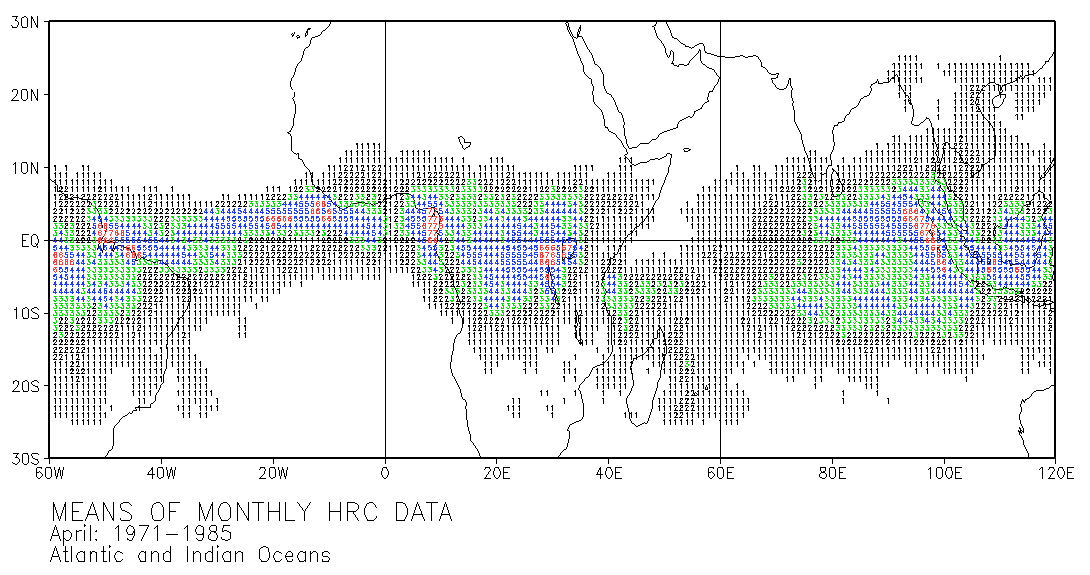
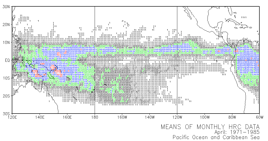
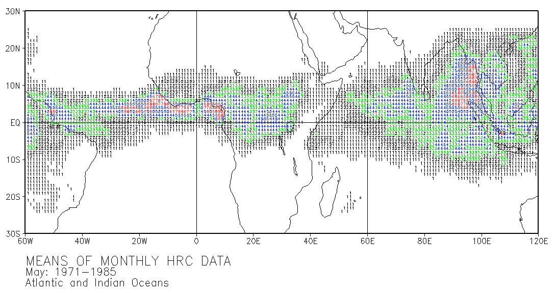
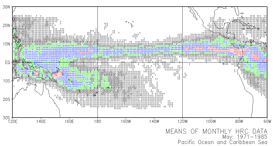
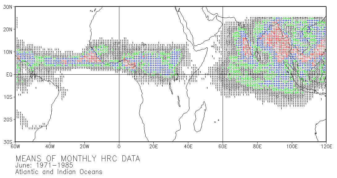
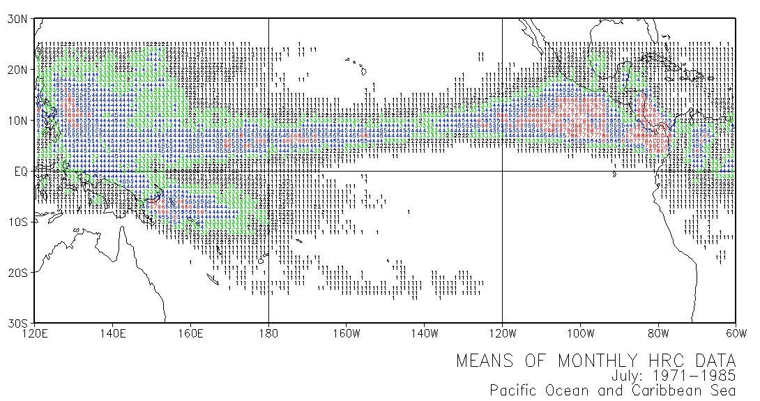
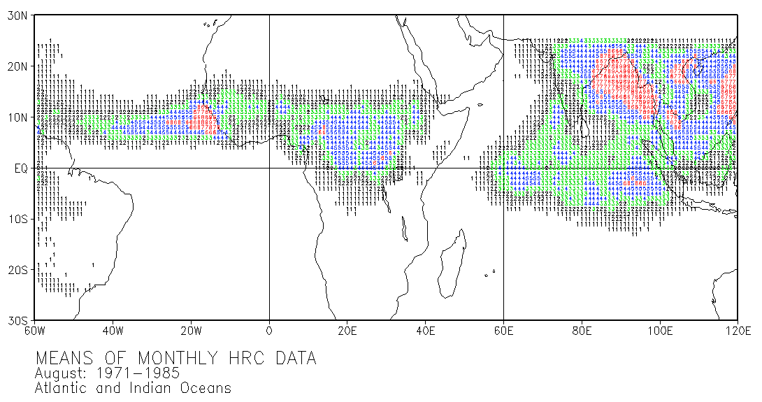
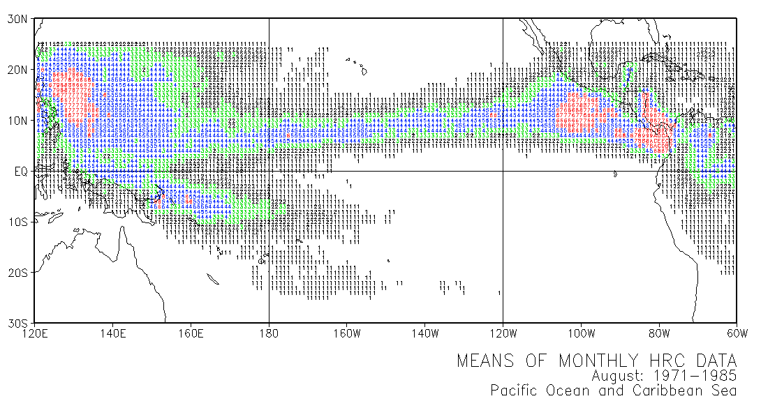
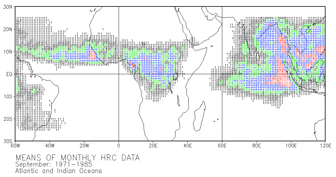
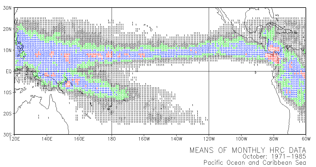
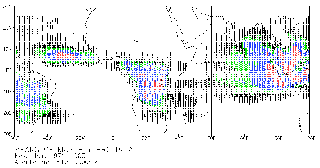
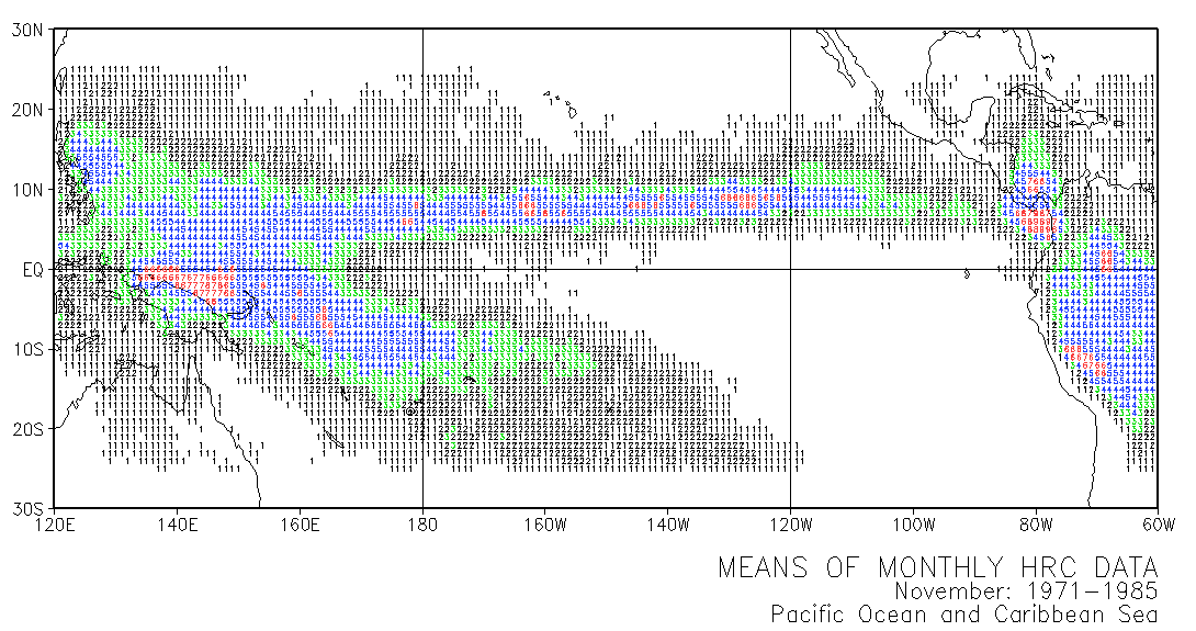
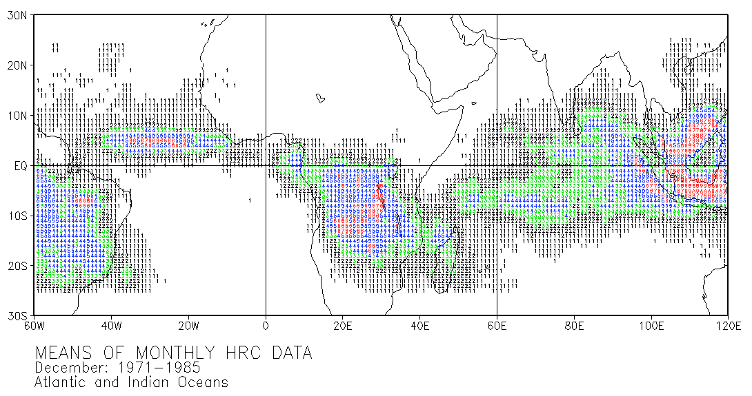
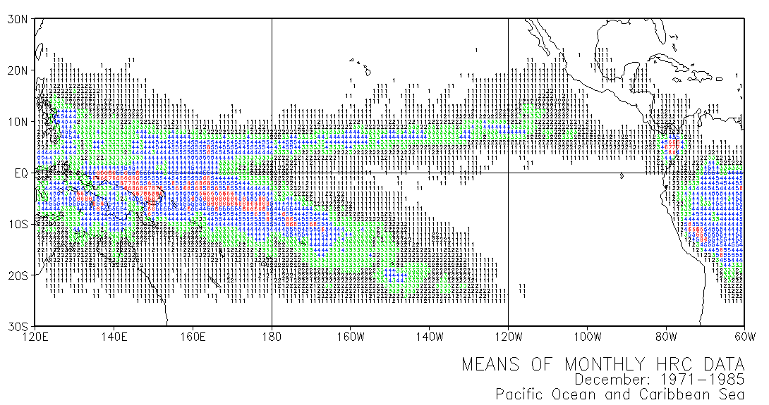
These maps use numbers in grid squares to show mean numbers of days with highly reflective clouds (HRC) in given locations. Each of the 12 double-page maps represent data for 15 years of a given month. For example. the means on the January map were calculated from the number of days with HRC for every January in the period 1971-1985. The calculations used the normalized data presented in Part III.
Number     Color
----------------
1,2        Black
3          Green
4,5        Blue
>=6        Red
MEANS OF MONTHLY HRC DATA
Jan: 1971-1985 Atlantic and Indian Oceans Pacific Ocean and Caribbean Sea

Feb: 1971-1985 Atlantic and Indian Oceans Pacific Ocean and Caribbean Sea

Mar: 1971-1985 Atlantic and Indian Oceans Pacific Ocean and Caribbean Sea

Apr: 1971-1985 Atlantic and Indian Oceans Pacific Ocean and Caribbean Sea

May: 1971-1985 Atlantic and Indian Oceans Pacific Ocean and Caribbean Sea

Jun: 1971-1985 Atlantic and Indian Oceans Pacific Ocean and Caribbean Sea

Jul: 1971-1985 Atlantic and Indian Oceans Pacific Ocean and Caribbean Sea

Aug: 1971-1985 Atlantic and Indian Oceans Pacific Ocean and Caribbean Sea

Sep: 1971-1985 Atlantic and Indian Oceans Pacific Ocean and Caribbean Sea

Oct: 1971-1985 Atlantic and Indian Oceans Pacific Ocean and Caribbean Sea

Nov: 1971-1985 Atlantic and Indian Oceans Pacific Ocean and Caribbean Sea

Dec: 1971-1985 Atlantic and Indian Oceans Pacific Ocean and Caribbean Sea