R/V Ronald H. Brown Daily Summaries
Daily Summary July 14, 2002, DOY = 195
As of 0800 ET the ship was 86 nm off Delaware Bay Heading northeast at 12.5 knots. Moderate to light winds from the East. Data transfer among investigators over the ship web and file servers has commenced. The transfer of fifteen-minute averages of targeted data for model evaluation purposes has begun. The ship turned into the approaches to New York Harbor at 1500 ET and sailed Northwest toward Manhattan. Throughout the day the flow was generally from the east. The concentrations of all compounds associated with anthropogenic pollution remains low with the exception of brief excursions associated with passing ships.
For all plots, time is indicated in GMT. Eastern time is -5 hours.
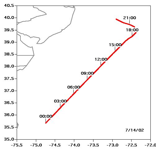 Location |
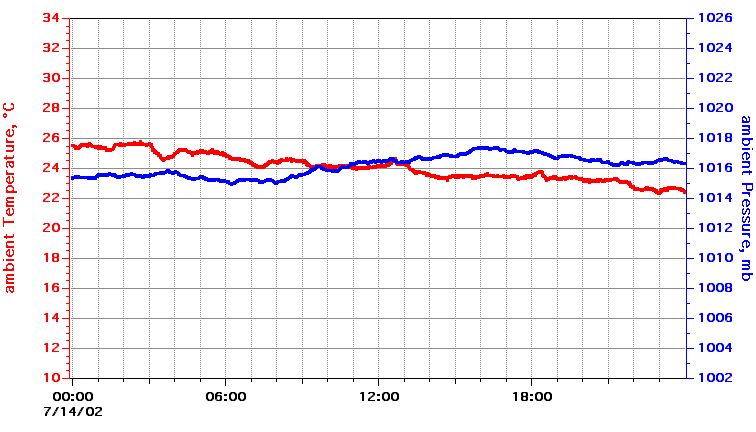 Temperature, Pressure |
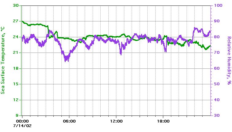 Sea Surface Temperature, Relative Humidity |
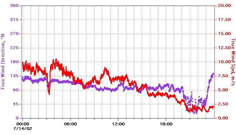 True Wind Speed, Direction |
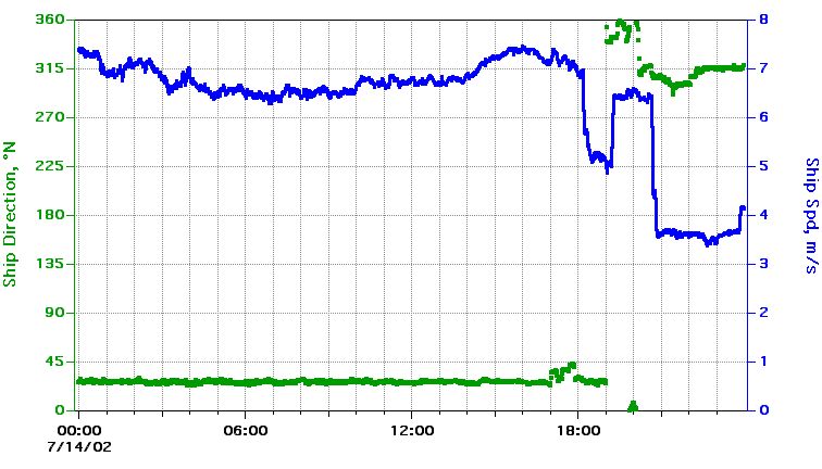 Ship Speed, Direction |
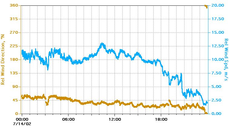 Relative Wind Speed, Direction |
Textual information and data plots are for quicklook and overview purposes only.