CalNex 2010 TOPAZ Lidar data
May 25 - Flight B - Preliminary Data
| Previous Flight | Archive Calendar | Next Flight |
|---|
Flight #4: Los Angeles Basin
Flight level: 10500 - 12500 MSL
Takeoff : 16:30 PST
Duration : 3:00 h
Objective : Characterize 3-d distribution of ozone over the LA Basin
Select an image to view full resolution
Ozone in Google Earth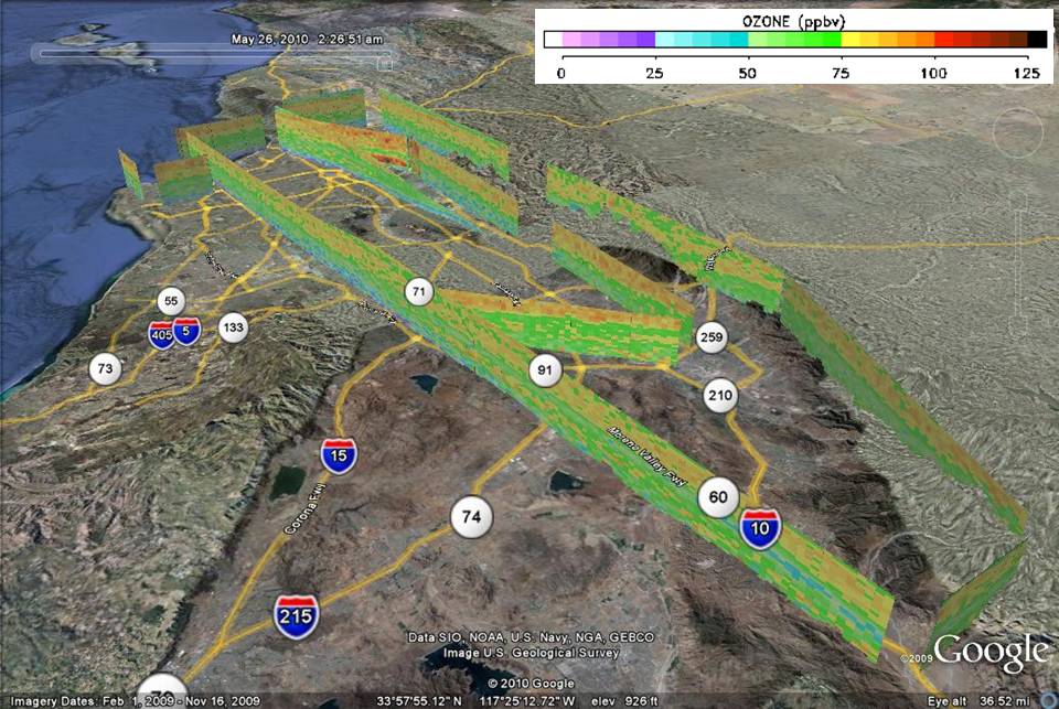 Get the Google Earth kml file |
Ozone Cross-section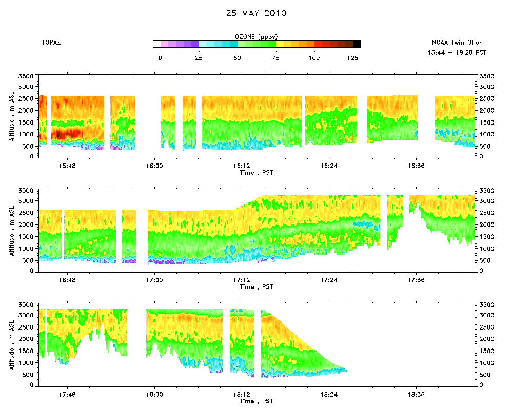 Download the ASCII file |
|---|