CalNex TOPAZ Lidar data
June 29 - Flight B - Preliminary Data
| Previous Flight | Archive Calendar | Next Flight |
|---|
Flight #31: Transit to Ontario-San Jose to San Joaquin Valley
Flight level: 10500-11500 MSL
Takeoff : 12:29 PST
Duration : 3:49 h
Objective : Takeoff at Moffet Field, land at ONT. Map the horizontal and vertical distribution of pollution in the San Joaquin Valley, characterize boundary conditions inside the PBL and the residual layer.
Select an image to view full resolution
Ozone in Google Earth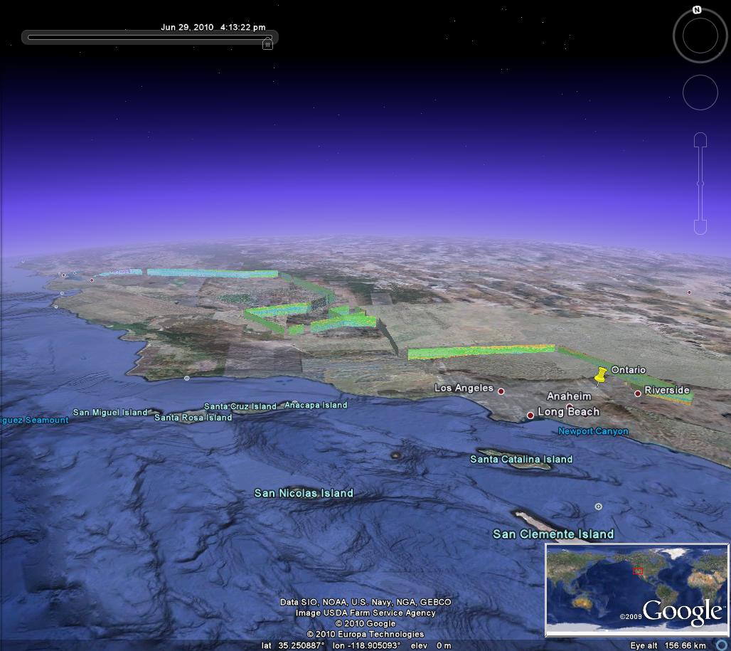 Get the Google Earth kml file |
Ozone Cross-section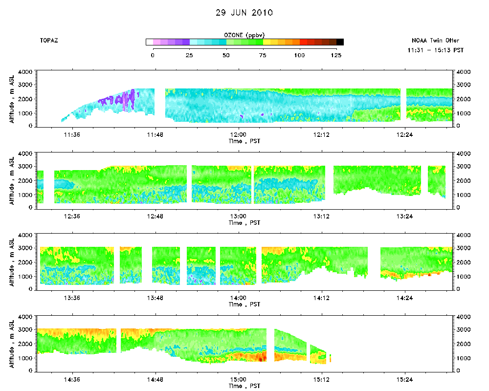 Download the ASCII file |
|---|