April and April-May-June forecast
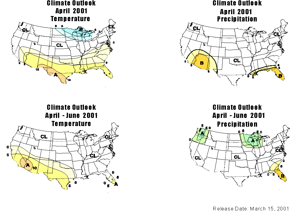
DISCUSSION: The climate outlook for temperature in April (above upper right)is for an increased probability of upper tercile temperatures (above normal) for much of the sourthern tier of the U.S,including west Texas, southern New Mexico, Arizona, and southern California. This region is expanded somewhat for the April-May-June (lower right). Note that this is for the *average* for the month of April and the three month average AMJ.
The climate outlook for precipitation for April '01 (above upper left) is for increased risk of lower tercile precipitation (below normal) for the lower Colorado Basin, western New Mexico (including the southern San Juan basin), and southern California. There is a slightly increased probability that the total precipitation for April in the lower Colorado Basin will be in the *driest* tercile.
The state of Colorado is in a region for which the outlook is CL, for "climatology," that is, there are about equal chances of each of the three categories, below noremal, near normal, or above climate normalsDEFINITIONS: 1) "terciles" refer to three equally probable categories of the distribution of precipitation or temperature for each area and each month or season. Climate data for a region and season are divided into the third (upper tercile, wettest or warmest), middle third (middle tercile, near normal), and lower third (lower tercile, driest or coolest). By chance, there's a 33% risk that any given year would fall in each of these terciles. On the outlook maps, these categories are A=above normal; N=near normal, and B=below normal. In practice, N is rarely forecast in these outlooks. More commonly, and often misrepresented as normal, CL is indicated, which means "climatology." CL indicates that there are about equal chances that conditions will be below normal, near normal, or above climate normals. Another way of putting this is that there is no information on if there is an increased probability that conditions will be in any category. To determine how much the probability is changed, you add the number on the map to the climatological probability of 33%. The medium yellow indicates a probability anomanomaly of 5-10%, which is added to 33%, thus the risk increases to between 38-43% that the accummulated ppt in that month or season will be in the category denoted by the letter, A= above normal, B-below normal. By the way, 10% increased risk may not seem like much, but it actually represents a fairly substantial increase as forecasts for precipitation go.
2) all the comparisons are made to a "base period" of 1961-1990; in the next several months, the base beriod for comparison will change to 1971-2000
Long-Lead forecast
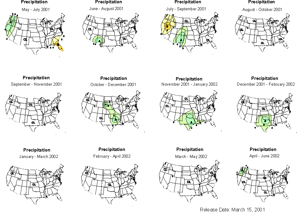
The long-lead outlooks for precipitation (above)for 3-month overlapping seasons has little information for the Colorado Basin until the summer. For Colorado and New Mexico, there is a slightly increased probability of above normal precipitation in the July-Sept monsoon period. Individual seasons can be viewed by clicking on the season you want from at this index. You can also read the technical long lead prognostic discussion .
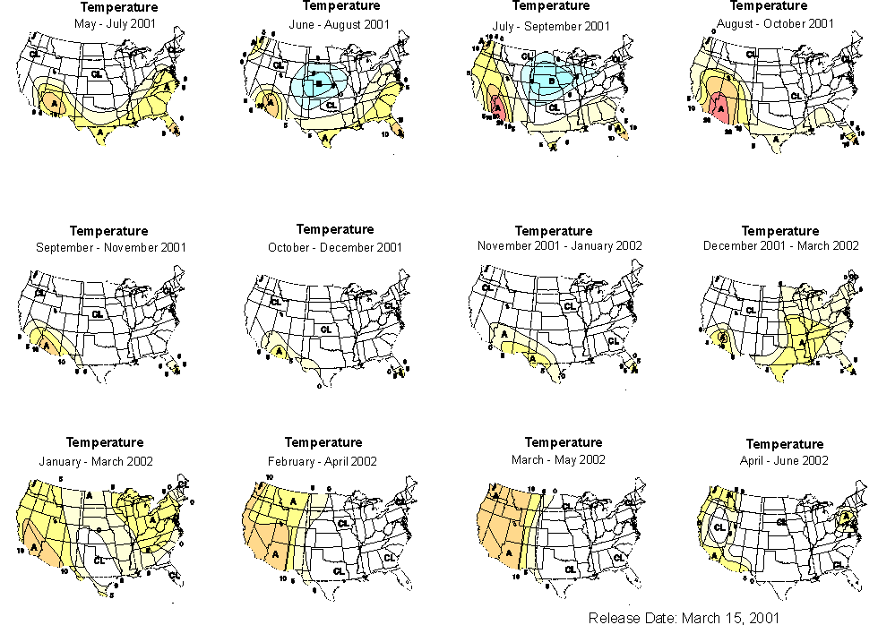
The long-lead outlooks for temperature (above) continues the outlook for the AMJ season for above normal temperatures in the southern tier, including Arizona, (see the prognostic discussion of the long lead forecast, for a technical discussion)
Please feel free to contact me if you have futher questions, andrea.ray@noaa.gov, 303-497-6434. To see my description of last month's forecast, see below.