Distant Impacts: Smoke, dust from Pacific Northwest fires affect Colorado's air quality
November 16, 2016
During poor air quality days in Denver last year, scientists found that specks of mineral dust swept into the region along with smoke from Pacific Northwest wildfires, they report in a new study published in the Journal of Atmospheric Chemistry and Physics. Both smoke and mineral dust have consequences not only for health, but also for climate.
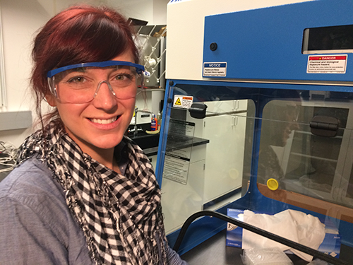
Lead author Jessie Creamean, a CIRES scientist at the NOAA Earth System Research Laboratories (ESRL), said the finding was serendipitous. During the summer of 2015, she was testing new sensor on the roof of the NOAA building in Boulder. The instrument, which measures the mass and chemistry of particles, suddenly recorded large spikes in the data, indicating the presence of higher-than-usual levels of certain aerosols.
Around the same time, Creamean was out biking when she began coughing and had trouble breathing and realized she was experiencing poor air quality first-hand. Curious, she set out to determine what could be causing that bad air, and the spike in aerosols detected by the sensor.
Scientists have long known that smoke can travel far, fast, but few have documented that fires also inject other particles like dust into the atmosphere. “Now we’ve documented that smoke from wildfires can kick up dust which can be transported long distances, affecting climate and health in regions far from those fires,” said Creamean, a researcher with ESRL's Physical Sciences Laboratory (PSL).

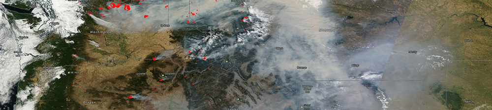
Creamean started by looking at images of the U.S. West from NASA’s MODIS satellite from August 2015. Late that month, several “hot spots” marked fires in the Pacific Northwest region, and their smoke stretched from the West into other states, including Colorado.
Next, Creamean and colleagues documented three separate poor air quality events in the Denver Metro area during that time using data from the Colorado Department of Public Health and Environment (CDPHE). CDPHE issues an "action day" advisory when levels of fine particles (those smaller than 2.5 microns or PM 2.5) in the air are high, causing health problems including coughing, wheezing, reduced lung function, asthma attacks, heart attacks and strokes.
On those days with poor air quality, falling between August 15 and September 2, Creamean’s rooftop sensor also measured high levels of mineral dust and metals linked to forest fires and other types of biomass burning. Dust and smoke from biomass burning haze can affect more than health: they can also influence climate-related factors such as visibility, cloud formation, and surface radiation.

After using model simulations to see where the air reaching Boulder originated, Creamean enlisted the help of colleague Paul Neiman, a NOAA meteorologist at PSL, who verified her results using weather data from the same time period. He found that a combination of unique large-scale weather events in the western U.S. and local conditions in Colorado were just right to enable winds to carry the smoke and dust so far and cause the bad-air days that Creamean documented. To verify that dust and smoke were present along the pathways that these air masses traveled, the researchers used NASA’s CALIPSO satellite.
Creamean and colleagues also showed that in between the hazy days were good air quality days, also well modeled and marked by lower concentrations of biomass burning and mineral metals. On those days, the atmospheric conditions transported smoke and dust away from the Colorado Front Range.
So just because something happens far away doesn't mean it won't impact you. “It’s important to understand how these aerosol populations can be influenced by long-range-transported smoke and dust, particularly those from large-source contributors such as wildfires,” said Creamean.
These observations can help scientists understand how aerosols from wildfires and other biomass burning travel through space and time, and how they affect air quality and climate in far places. This knowledge could inform health standards and climate models.