
Measurements at the Mauna Loa Observatory stopped after the 2022 eruption of the Mauna Loa volcano, when lava flow crossed the access road and took out power lines to the facility. The observatory remains inaccessible by vehicle and without power from the local utility company.
Observatory staff has established limited solar power in four observatory buildings and restored approximately 33 percent of the measurements onsite, including the Global Monitoring Laboratory and Scripps critical CO2 records and other atmospheric measurements.
Media can contact: Theo Stein (303) 819-7409 (theo.stein@noaa.gov) or Karin Vergoth 303-632-6413 (karin.vergoth@noaa.gov)
![]() Partnering organizations in the project are:
NOAA, University of Hawaii, Mount Washington Observatory, Michigan Aerospace Corporation.
Partnering organizations in the project are:
NOAA, University of Hawaii, Mount Washington Observatory, Michigan Aerospace Corporation.
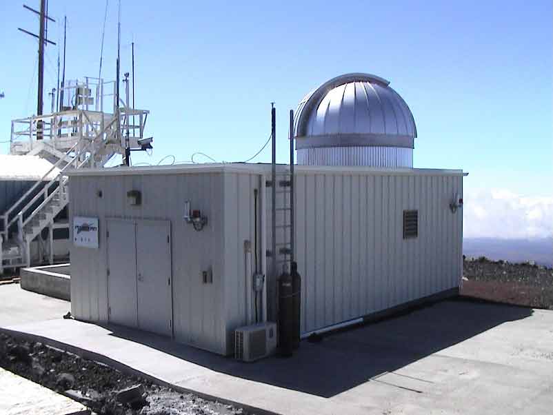
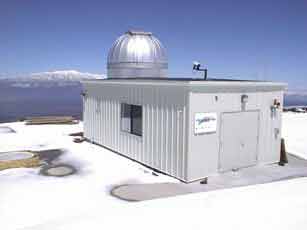
The GroundWinds LIDAR instrument is a technology demonstration of a ground system that might later be deployed on a satellite platform. The LIDAR system measures the velocity and direction of winds up to 20km. We are able to measure wind velocity down to 1m/s.
View a schematic diagram of the Groudwinds Lidar System
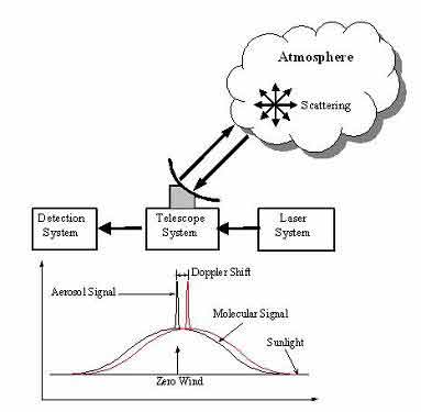
The LIDAR transmits short pulses of laser light (355nm) along the optical axis of a telescope into the
atmosphere. The 5W laser light is scattered by the molecules and aerosols in the atmosphere resulting in a
detectable back scattered light signal. At each altitude, the scattered laser light returns to a receiver
telescope. A fiber optic cable carries the scattered light from the telescope to an interferometer system. A
comparison is made of the outgoing and incoming laser pulses using the Doppler shift. The instrument operates
continuously at Mauna Loa.
Presently, wind measurements are made by an instrument called a radiosonde. It is only capable, however, of making these measurements over land masses and only at set intervals of time. The Groundwinds technology is capable of being put onto a satellite platform to make global wind measurements, especially over the oceans where critical wind data is unavailable.
The instrument was put into full operation in March of 2003. The data is currently being analyzed in conjunction with the University of Hawaii on a ongoing basis.
Once this instrument is put onto a satellite platform orbiting the earth, it will provide more accurate global wind measurements thereby improving weather forecasting.
The GroundWinds instrument is a technology demonstration of a ground system that might later be deployed on a satellite platform. The GroundWinds direct detection Doppler lidar system utilizes a two-channel Fabry-Pérot interferometer as a high spectral resolution element, capable of detecting Doppler shifts of the back scattered signal corresponding to velocities less than 1 meter per second (1 m-s-1). This interferometer is the direct descendant of the High Resolution Doppler Imager (HRDI) (Hays, et al, 1993) employed on the Upper Atmosphere Research Satellite (UARS) and the Fabry Perot Interferometer (FPI) (Hays et al, 1981) employed on the Dynamics Explorer (DE). The GroundWinds lidar consists of a laser transmitter that transmits a narrow pulse of nearly single frequency light, and a receiver that measures and records the frequency shifts in the back scattered laser light. The receiver measures the spectrum of back scattered light at a high rate. These spectra are analyzed to deduce the Doppler shift of the light as a function of altitude. This spectrum consists of two components: a broad component from the Rayleigh scattering from atmospheric gases, and a narrow component from the Mie scattering from atmospheric aerosols. The GroundWinds system employs both components to measure the wind velocity. The aerosol component, when present, provides an accurate wind measurement, but aerosol concentrations vary greatly with geographic location, altitude, season, and even time of day. However, the molecular component is always present, and we use it as the primary source of information to measure the winds. Each of these components is measured independently with different interferometers designed for that component. Figure 1 (click here to view) illustrates how transmitted laser light, that has been scattered by the atmosphere, is gathered by a telescope and processed by the detection system.
Dr. Berrien Moore (UNH)
603-862-1727
Ivan Dors
603-862-2867
John E. Barnes
808-933-6965 (x222)
David Nardini
808-933-6965 (x229)
http://groundwinds.sr.unh.edu/
March, 2002


