The Boulder SURFRAD instruments are located on the deck at
SRRB's Table Mountain Test Facility, located
8 miles north of Boulder. These instruments are part of a larger set
maintained at this location and used for annual intercomparisons and other
research.
| Table Mountain, Colorado |
|---|
| Latitude: | 40.12498 degrees North |
| Longitude: | 105.23680 degrees West |
| Elevation: | 1689 meters |
| Time Zone: | Local Time + 7 hours = UTC |
| Installed: | July 1995 |
|
SURFRAD data from the Boulder site.
|
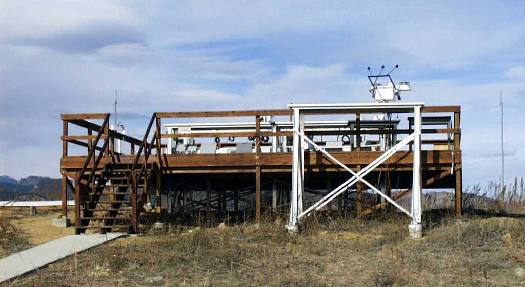
The instrument deck at the Table Mountain Test Facility. Note the
SURFRAD solar tracker on the platform in front of the deck.
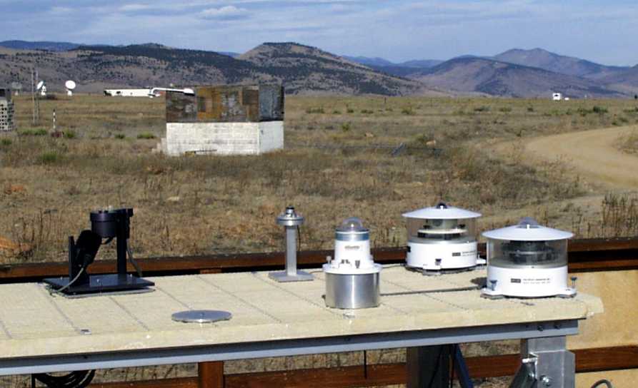
The downwelling SURFRAD instruments, located on the north table of the deck.
Shown, from left to right, are: Yankee Environmental Systems (YES) MFRSR,
LI-COR PAR, Yankee UVB-1 Ultraviolet Pyranometer, ventilated Eppley pyrgeometer
and ventilated Spectrosun pyranometer.
SURFRAD instruments mounted on the SCI-TEC 2AP solar tracker on the
south side of the deck. On the tracker there are three shaded instruments:
a ventilated Spectrosun pyranometer, a Yankee UVB-1 Ultraviolet Pyranometer
(not SURFRAD), and a ventilated Eppley pyrgeometer. A SCI-TEC quadrant detector
detector and an Eppley normal incidence pyranometer are also mounted on the
sides of the tracker.
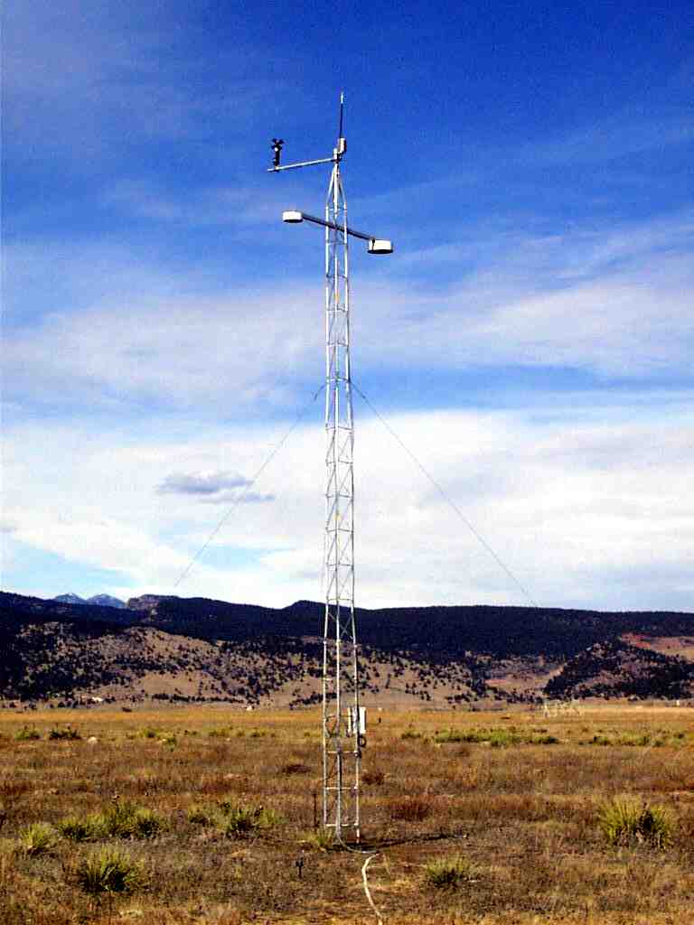
The SURFRAD ten-meter tower, located approximately 100 yards north of the
instrument deck. The tower contains an RM Young wind monitor, a Vaisala
temperature and relative humidity sensor, and an Eppley pyrgeometer
and a Spectrosun pyranometer for measuring upwelling infrared and
upwelling solar radiation, respectively.
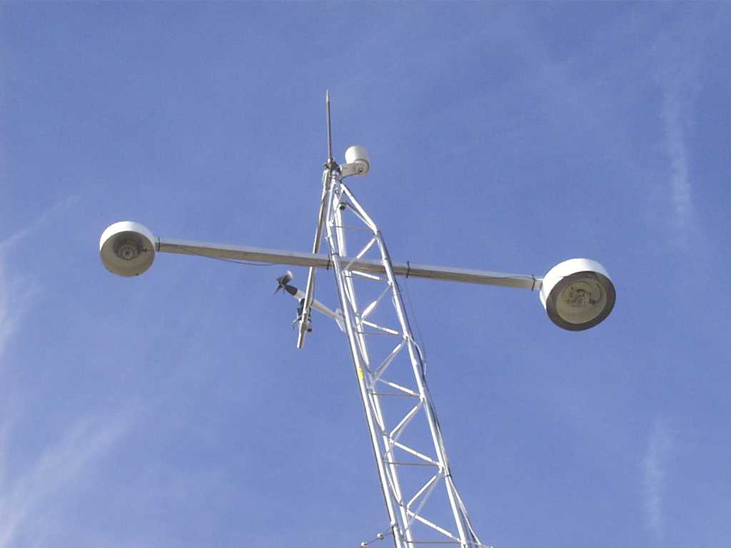
A close-up of the tower-mounted instruments.