
WinterStorms 2007 G-4 Flight Track Map
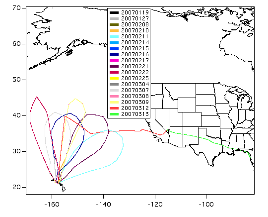
The map shows the 18 flights of the NOAA G4 aircraft during the 2007 Winter Storms project. The legend indicates the date when the flight originated in yyyymmdd (4 digit year, 2 digit month, 2 digit day) format and is color coded.
The science objectives of the majority of flights shown here were reconnaissance efforts to assist in West Coast weather forecasting.