R/V Ronald H. Brown Daily Summaries
Daily Summary July 22, 2002, DOY = 203
The winds during the period were predominantly from the south through the southeast, which favored transport from the NY/Boston area. Clear shies and modest wind speeds also favored photochemical processing and pollution accumulation in the Gulf of Maine.
During the early morning hours the ship transected from a point northeast of the tip of Cape Anne to a point about 5 nm southeast of the Seabrook nuclear plant. After daybreak this track was extended closer to shore and shortened to allow for frequent sampling of a pollution plume located near the northwest end of the nighttime track. The plume had elevated levels of SO2, NOy, SO2, CO, VOCs. and aerosols. The ship continued to traverse the plume throughout the day. By the afternoon ozone levels were approaching 100 ppb and SO4 levels were above 12 ug/m3. The DOE G-1 performed a number of low passes over the ship in the early afternoon and performed a spiral overhead. The crew reported a number of pollution layers that were also seen on the ozone/aerosol lidar.
During the early evening hours the ship moved northward just east of the Isles of Shoals and then made a run to the east to determine the spatial extent of the polluted air mass.
For all plots, time is indicated in GMT. Eastern time is -5 hours.
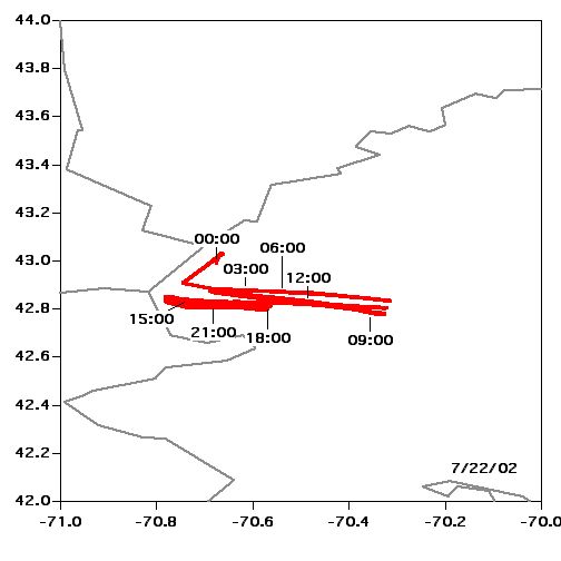 Location |
 Temperature, Pressure |
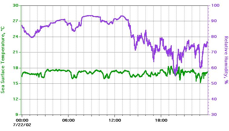 Sea Surface Temperature, Relative Humidity |
 True Wind Speed, Direction |
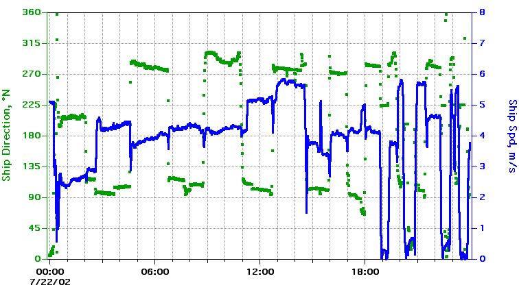 Ship Speed, Direction |
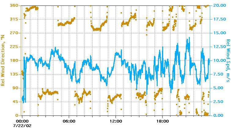 Relative Wind Speed, Direction |
Textual information and data plots are for quicklook and overview purposes only.