TexAQS 2006 TOPAZ Lidar data
August 28 - Final Data
| Previous Flight | Archive Calendar | Next Flight |
|---|
Flight #15
Takeoff: 12:30 CDT
Total flight time: 5.8 hours
The main objective of this flight was a coordinated mission with the NASA King Air, CIRPAS Twin Otter, and Ron Brown to characterize the aerosol structure along the flight track of the CALIPSO satellite. At the time of the CALIPSO overpass the Twin Otter flew a box pattern near the Ron Brown to characterize aerosol variability perpendicular to the satellite track. At the same time, the CIRPAS Twin Otter was sampling at about 1000 MSL and the NASA King Air with its HSRL aerosol lidar was flying overhead at 28,000 . After the satellite overpass, the NOAA Twin Otter headed north on the Calipso satellite track. The intention was to fly about a 120-nmi segment of the satellite track in concert with the NASA King Air. However, this was thwarted by a large thunderstorm that developed over the western portion of Galveston Bay over the intended flight track, forcing the NOAA Twin Otter and the King Air to deviate from the satellite track and fly farther to the east. Still, about 45 minutes worth of coincident aerosol backscatter/extinction profile data at wavelengths of 300, 532, and 1064 nm was collected by the NOAA Twin Otter and the NASA King Air, providing a good opportunity for comparison and aerosol characterization. During the second half of the flight, the lidar onboard the Twin Otter experienced a malfunction. The remainder of the flight was spent diagnosing the problem and trying to repair the laser in flight. An in-flight repair was not possible, so no further data were collected on this flight. The instrument was successfully repaired the next day.
Select an image to view full resolution
Ozone Cross-section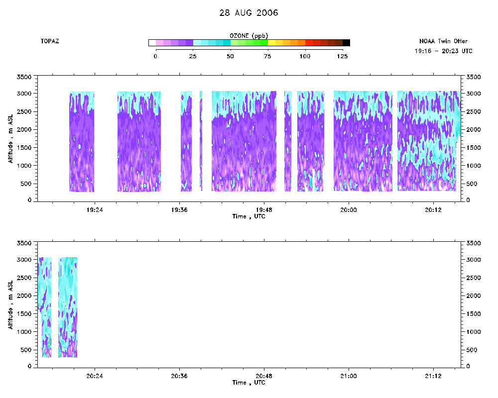 download ICARTT format data (ict file) download simple ASCII data (txt file) |
Aerosol Cross-section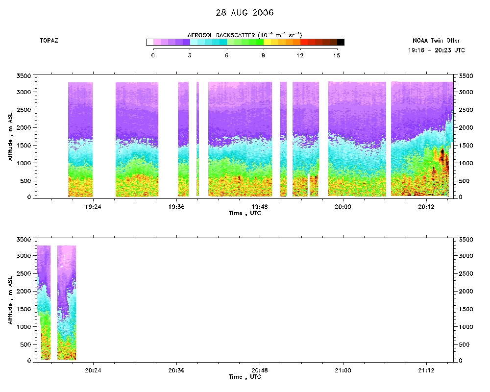 download ICARTT format data (ict file) download simple ASCII data (txt file) |
Ozone Map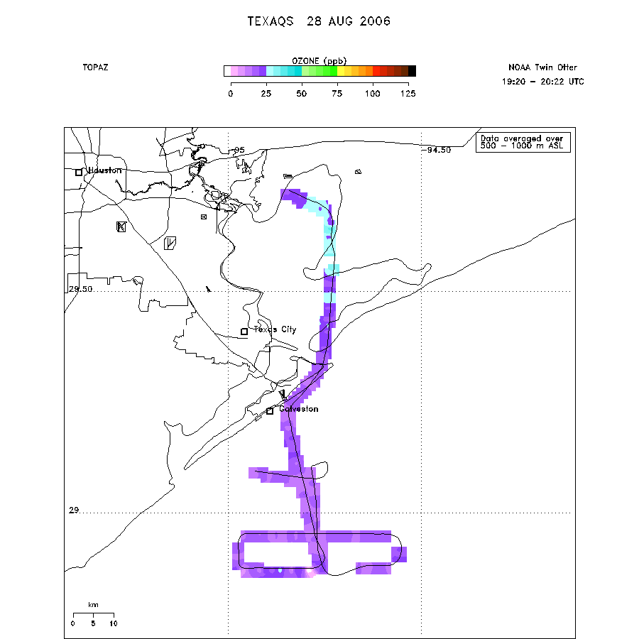 |
Mixed Layer Height Map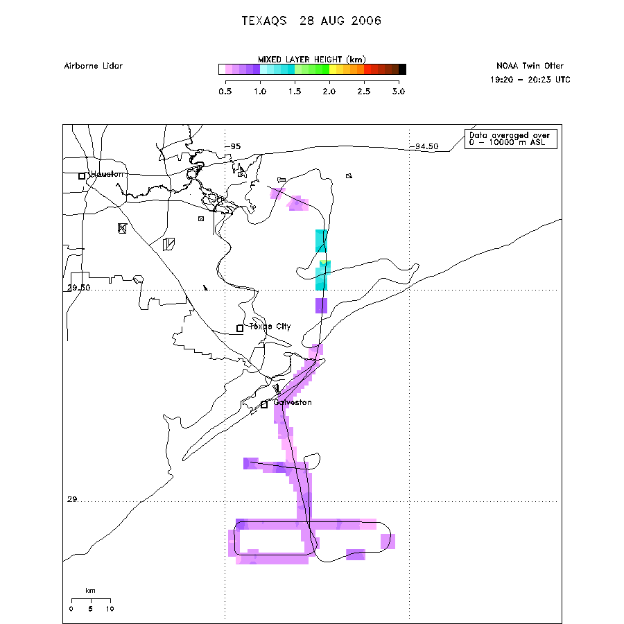 download ICARTT format data (ict file) download simple ASCII data (txt file) |