CalNex TOPAZ Lidar data
June 21 - Flight B - Preliminary Data
| Previous Flight | Archive Calendar | Next Flight |
|---|
Flight #20: Sacramento, Bay Area, northern San Joaquin Valley
Flight level: 9500 - 10500 MSL
Takeoff : 14:20 PST
Duration : 3:15 h
Objective : Survey pollution near Sacramento, south of Bay Area, and northern San Joaquin Valley; overfly T1 ground site
Select an image to view full resolution
Ozone in Google Earth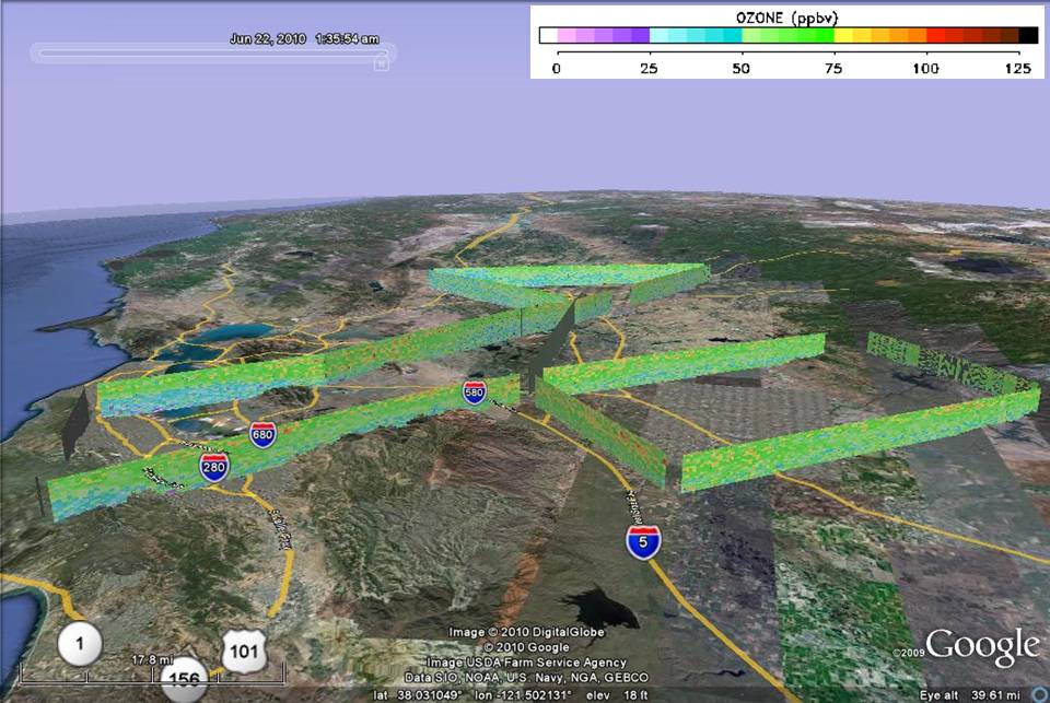 Get the Google Earth kml file |
Ozone Cross-section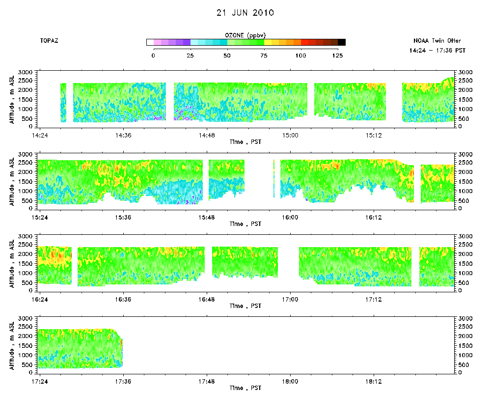 Download the ASCII file |
|---|