CalNex TOPAZ Lidar data
June 18 - Flight A - Preliminary Data
| Previous Flight | Archive Calendar | Next Flight |
|---|
Flight #17: Sacramento area, northern San Joaquin Valley
Flight level: 6500 - 15500 MSL
Takeoff : 11:30 PST
Duration : 3:15 h
Objective : Survey pollution in Sacramento area and northern San Joaquin Valley, compare with NOAA P-3 near Walnut Grove Tower
Select an image to view full resolution
Ozone in Google Earth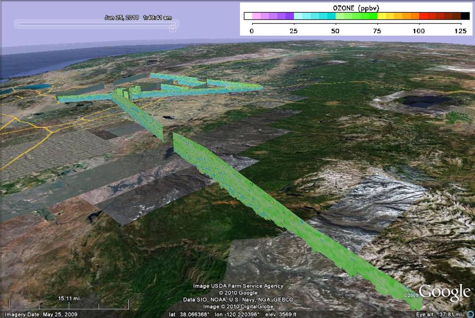 Get the Google Earth kml file |
Ozone Cross-section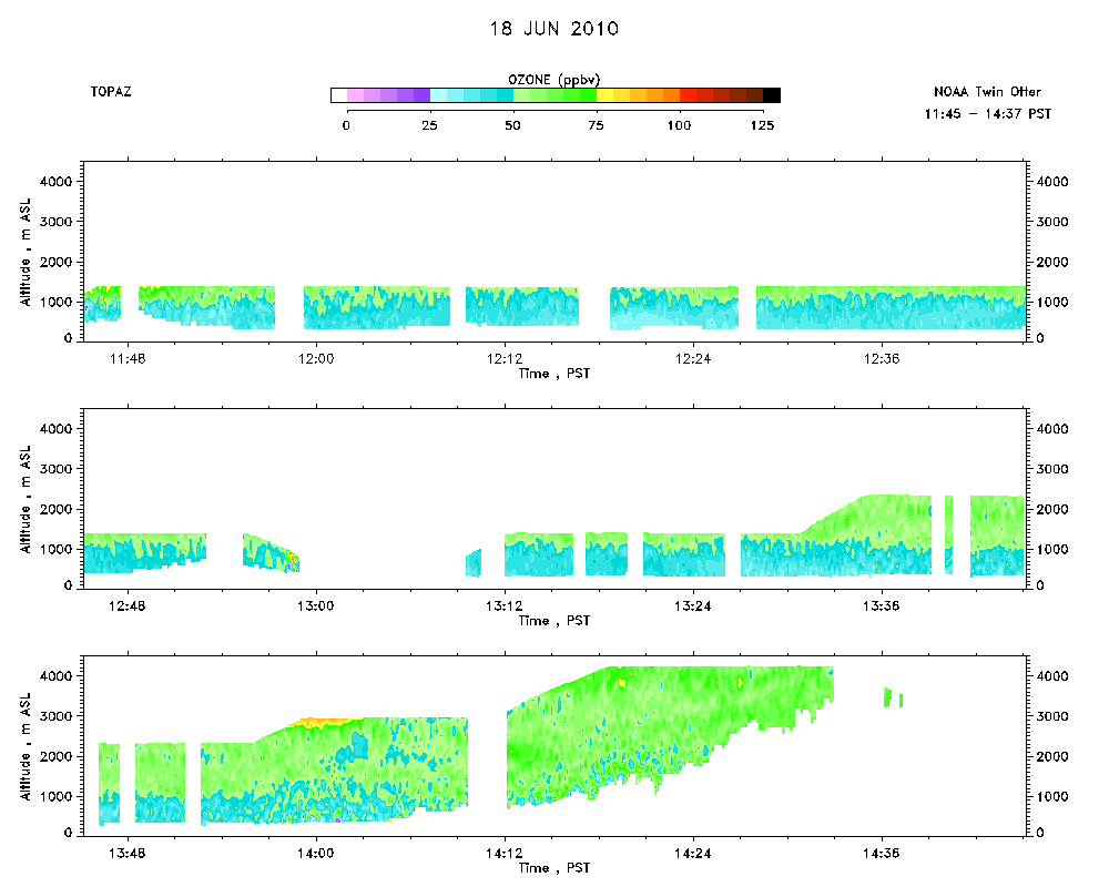 Download the ASCII file |
|---|