CalNex TOPAZ Lidar data
June 15 - Flight B - Preliminary Data
| Previous Flight | Archive Calendar | Next Flight |
|---|
Flight #16: Transit to Sacramento - Central Coast, San Joaquin Valley
Flight level: 9500 MSL
Takeoff : 15:15 PST
Duration : 3:00 h
Objective : Survey pollution in San Joaquin Valley, transport across Cottonwood Pass
Select an image to view full resolution
Ozone in Google Earth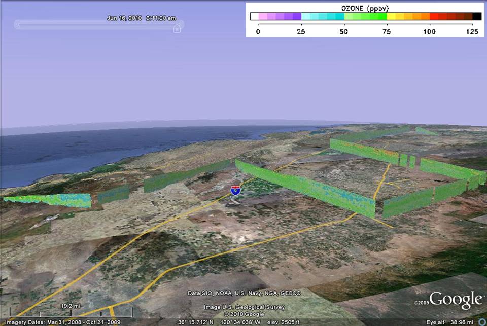 Get the Google Earth kml file |
Ozone Cross-section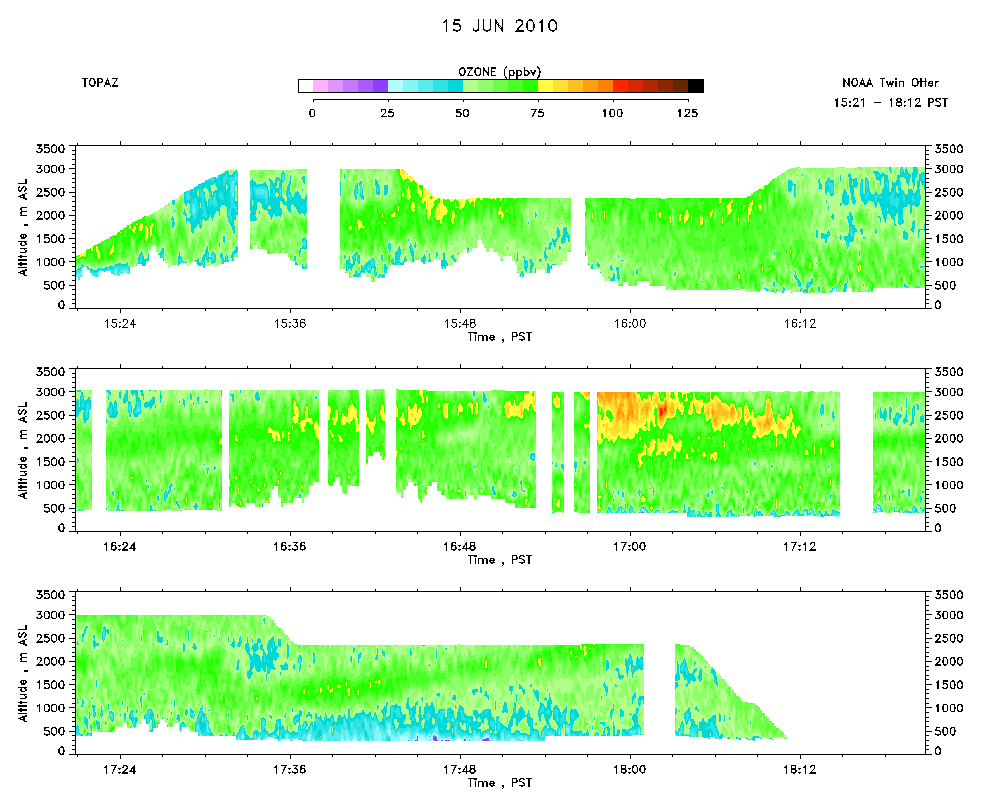 Download the ASCII file |
|---|