CalNex TOPAZ Lidar data
July 5 - Flight A - Preliminary Data
| Previous Flight | Archive Calendar | Next Flight |
|---|
Flight #36: Survey pollution in the northern LA basin
Flight level: 5500-8500 MSL
Takeoff : 10:30 PST
Duration : 4:00 h
Objective : Characterize 3-D distribution of O3 and other pollutants in the LA basin with close approach near Victorville for OMI overpass. Western half of basin was covered by stratus to 1000 m ASL.
Select an image to view full resolution
Ozone in Google Earth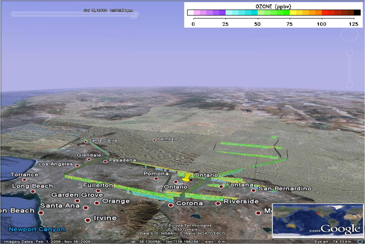 Get the Google Earth kml file |
Ozone Cross-section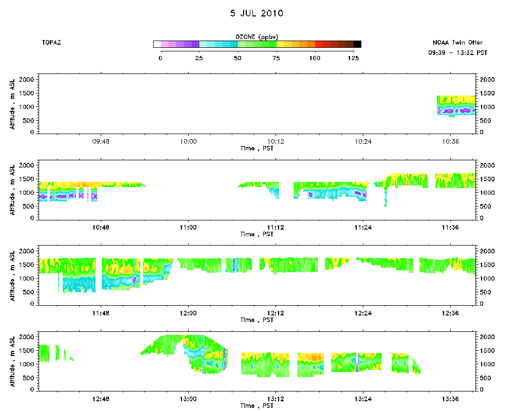 Download the ASCII file |
|---|