CalNex TOPAZ Lidar data
July 14 - Flight A - Preliminary Data
| Previous Flight | Archive Calendar | Next Flight |
|---|
Flight #40: Survey pollution in the San Joaquin Valley
Flight level: 12500-14500 MSL
Takeoff : 14:00 PST
Duration : 3:50 h
Objective : Survey O3 and other pollutants in the San Joaquin Valley. Study the role of mountain slope flows and the low level jet in redistributing pollutants .
Select an image to view full resolution
Ozone in Google Earth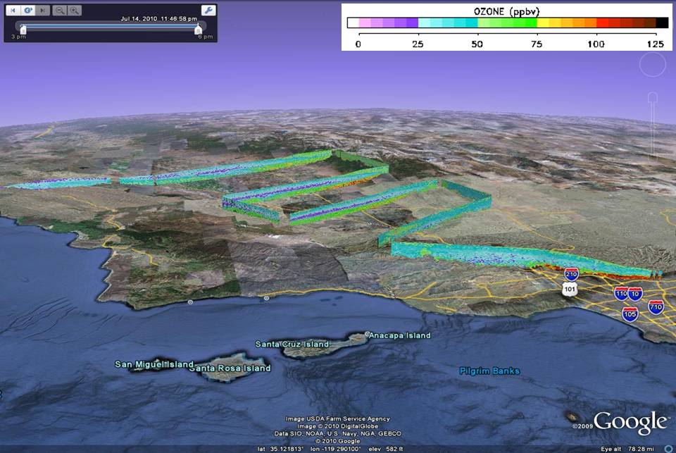 Get the Google Earth kml file |
Ozone Cross-section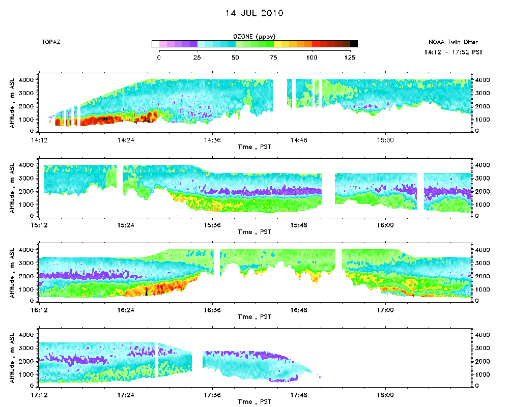 Download the ASCII file |
|---|