Atmospheric Remote Sensing: Instruments
Ozone Profiling Atmospheric Lidar (OPAL)
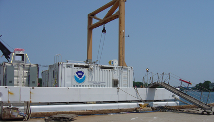
Decommissioned
Used to monitor ozone and aerosol formation, evolution and transport. Research applications include:
- Ozone formation/evolution monitoring
- Ozone transport studies
- Aerosol in polluted areas
Basic parameters measured:
- Ozone concentration profiles
- Particle backscatter profiles
Typical Specifications
| Wavelength | 266 nm | 289 nm | 299 nm | 355 nm | |
| Pulse energy | 6 mJ | 2 mJ | 2 mJ | 6 mJ | |
| Pulse rate | 1 - 10 Hz | ||||
| Scanning Directions | Vertical, horizontal, and in a single vertical plane | ||||
| Minimum range | 60 m | ||||
| Aerosol | |||||
| Maximum range | 1.5 - 3 km | 6 - 7 km | 6 - 7 km | 9 km | |
| Range Resolution | 15 m | ||||
| Ozone | |||||
| Maximum range | 3 km | ||||
| Range Resolution | below 1 km: 60 - 90 m 1 - 2 km: 100 - 150 m 2 - 3 km: 150 - 300 m | ||||
| Accuracy | Better than +/- 10 ppb | ||||
Specifications prior to 1999:
| Wavelength | 266 nm | 289 nm | 355 nm | |
| Pulse energy | 20 mJ | 1 mJ | 6 mJ | |
| Pulse rate | 2 - 10 Hz | |||
| Scanning Directions | Vertical, horizontal, and in a single vertical plane | |||
| Minimum range | 15 - 60 m | |||
| Aerosol | ||||
| Maximum range | 1.5 - 3 km | 6 - 7 km | 10 km | |
| Ozone | ||||
| Maximum range | 3 km | |||
| Accuracy | Better than +/- 10 ppb | |||
Field Projects
| Project Name | Date | Location | |
|---|---|---|---|
| TexAQS 2006 | Texas Air Quality Study 2006 | July-September 2006 | Houston, Texas |
| NEAQS 2004 | New England Air Quality Study 2004 | June-August 2004 | New Hampshire |
| NEAQS | New England Air Quality Study | July-August 2002 | New Hampshire |
| Aircraft Plume Study | May 2001 | ||
| TexAQS | Texas Air Quality Study | August-September 2000 | Houston, Texas |
| SOSA | Southern Oxidants Study SuperSite | August 1999 | Atlanta, Georgia |
| SOS | Southern Oxidants Study 99 | June-July 1999 | Nashville, Tennessee |
| SCOS | Southern California Ozone Study | June-October 1997 | El Monte, California |
| LIFT | Lidars In Flat Terrain | August 1996 | Champaign/Urbana, Illinois |
| VOTE | Victorville Ozone Transport Experiment | August 1995 | Victorville, California |
| LAFRS | Los Angeles Free Radical Study | September 1993 | Los Angeles, California |
| Davis | Davis Intercomparison Experiment | July 1993 | Davis, California |
References
Zhao, Y., R.D. Marchbanks, and R.M. Hardesty, Environmental Technology Laboratory's Transportable Lower Troposphere Ozone Lidar and Its Applications in Air Quality Studies, 42nd SPIE Annual meeting, Application of Lidar to Current Atmospheric Topics II, Proceedings of SPIE #3127, July 1997, 53-62.
Zhao, Y., R.M. Hardesty, and J.E. Gaynor, Demonstration of a new and Innovative Ozone Lidar's Capability to Measure Vertical Profiles of Ozone Concentration and Aerosol in the Lower Troposphere, Final report to the California Air Resources Board, December 1994.
Zhao, Y., R.M. Hardesty and M.J. Post, A Multibeam Transmitter for Signal Dynamic Range Reduction in Incoherent Lidar Systems, Applied Optics 45, 7623-7632, 1992.
Zhao, Y., J.N. Howell, and R.M. Hardesty, Transportable Lidar for the Measurement of Ozone Concentration and Aerosol Profiles in the Lower Troposphere, A&WMA/SPIE International Symposium on Optical Sensing for Environmental Monitoring, 11-14 October 1993, Atlanta, Georgia, 310-320.